I first heard about the protest at Standing Rock Sioux Reservation in North Dakota from actress Shailene Woodley. Back in August, she was following a group of youths who were literally running from Standing Rock to Washington, D.C., to protest the Army Corps of Engineers okaying the Dakota Access Pipeline to cross the Missouri River just a mile from the reservation.
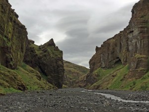
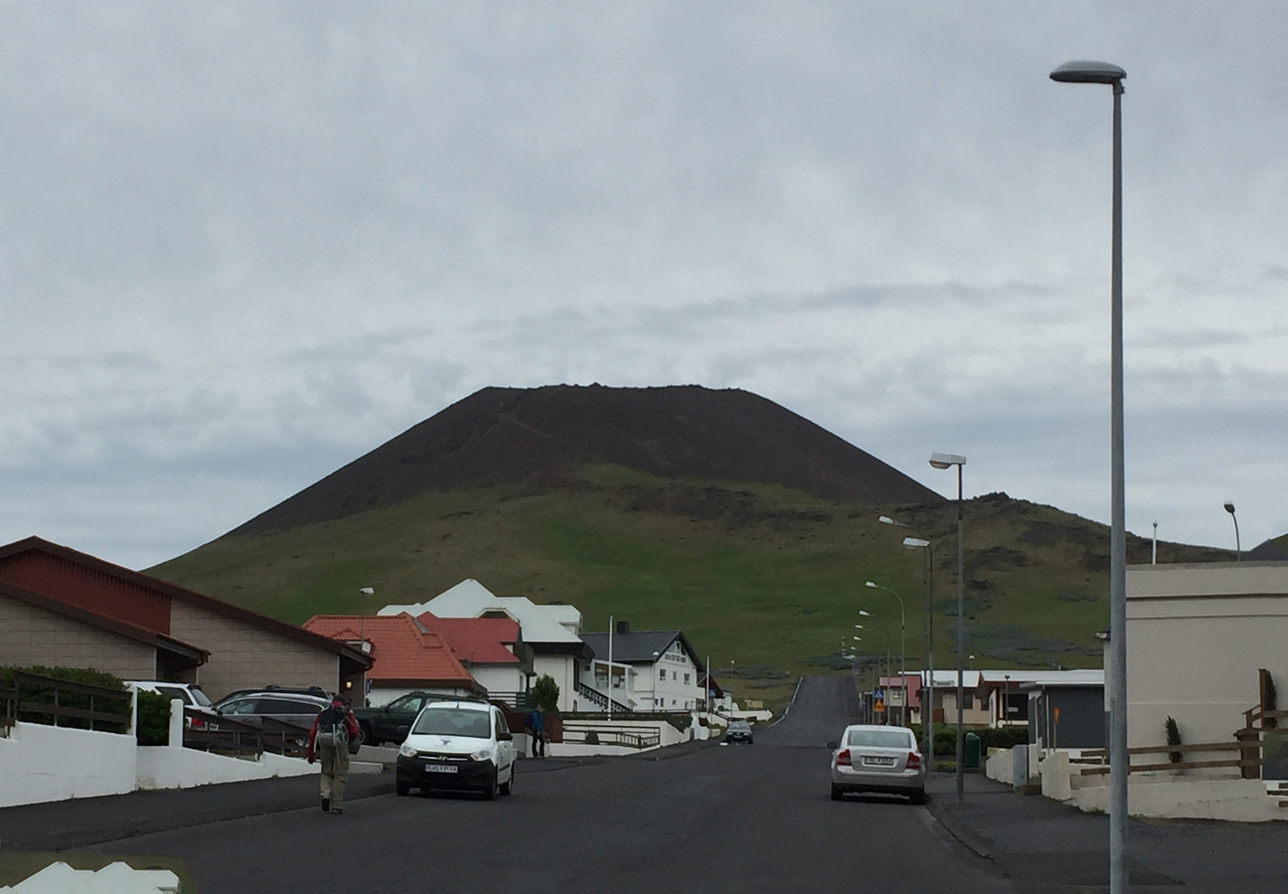
This was just the beginning of public attention to the battle against the Dakota Access Pipeline, a fight that started with a few hundred people camping out near the reservation in April. By the time I visited the Oceti Sakowin, or Seven Council Fires, camp over Thanksgiving, the number of campers had swollen to over 10,000. Why did this fight capture the attention of the nation?
Why Standing Rock?

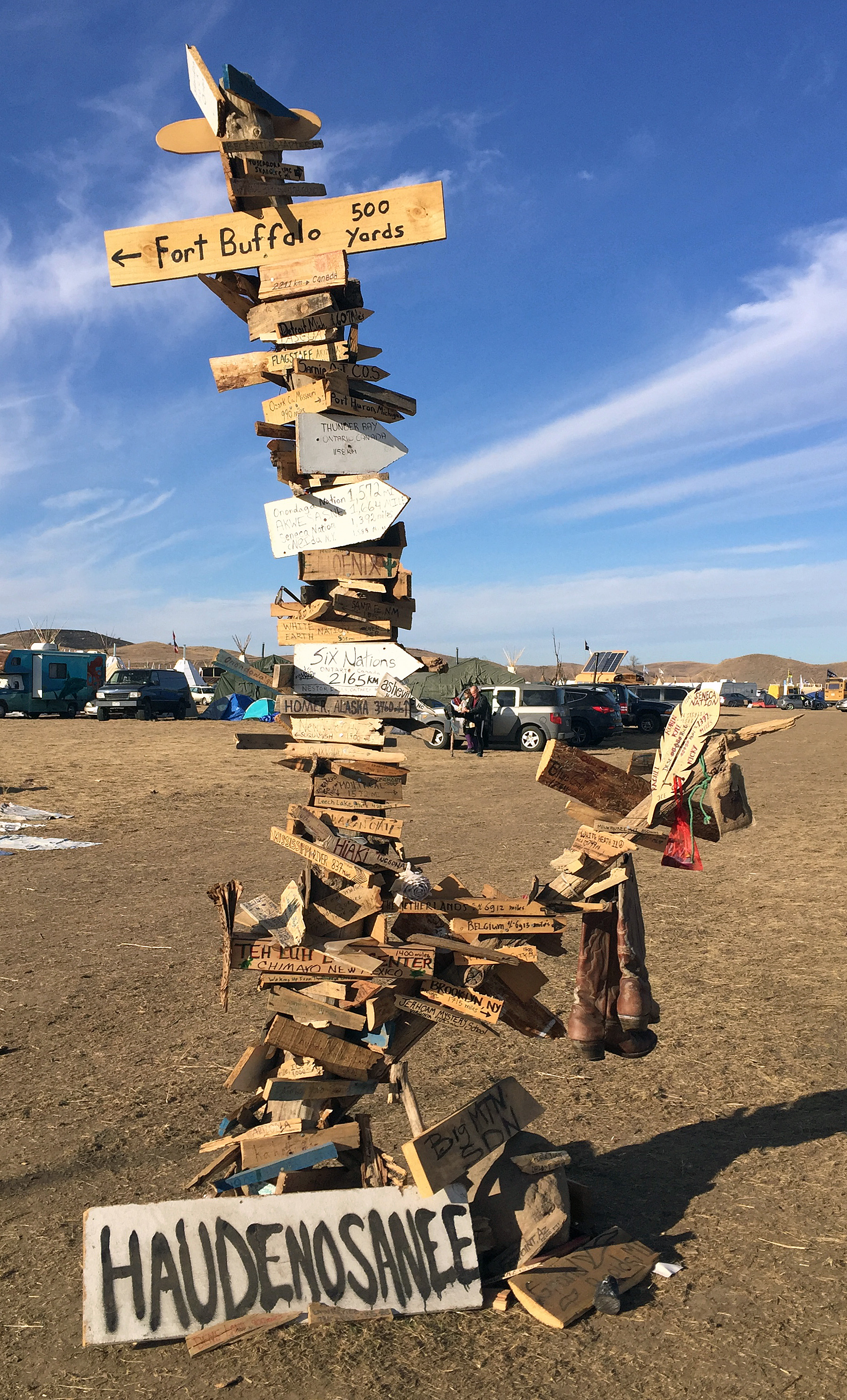
Flag Road leading into Oceti Sakowin camp. The flags of 300 tribal nations line this road.
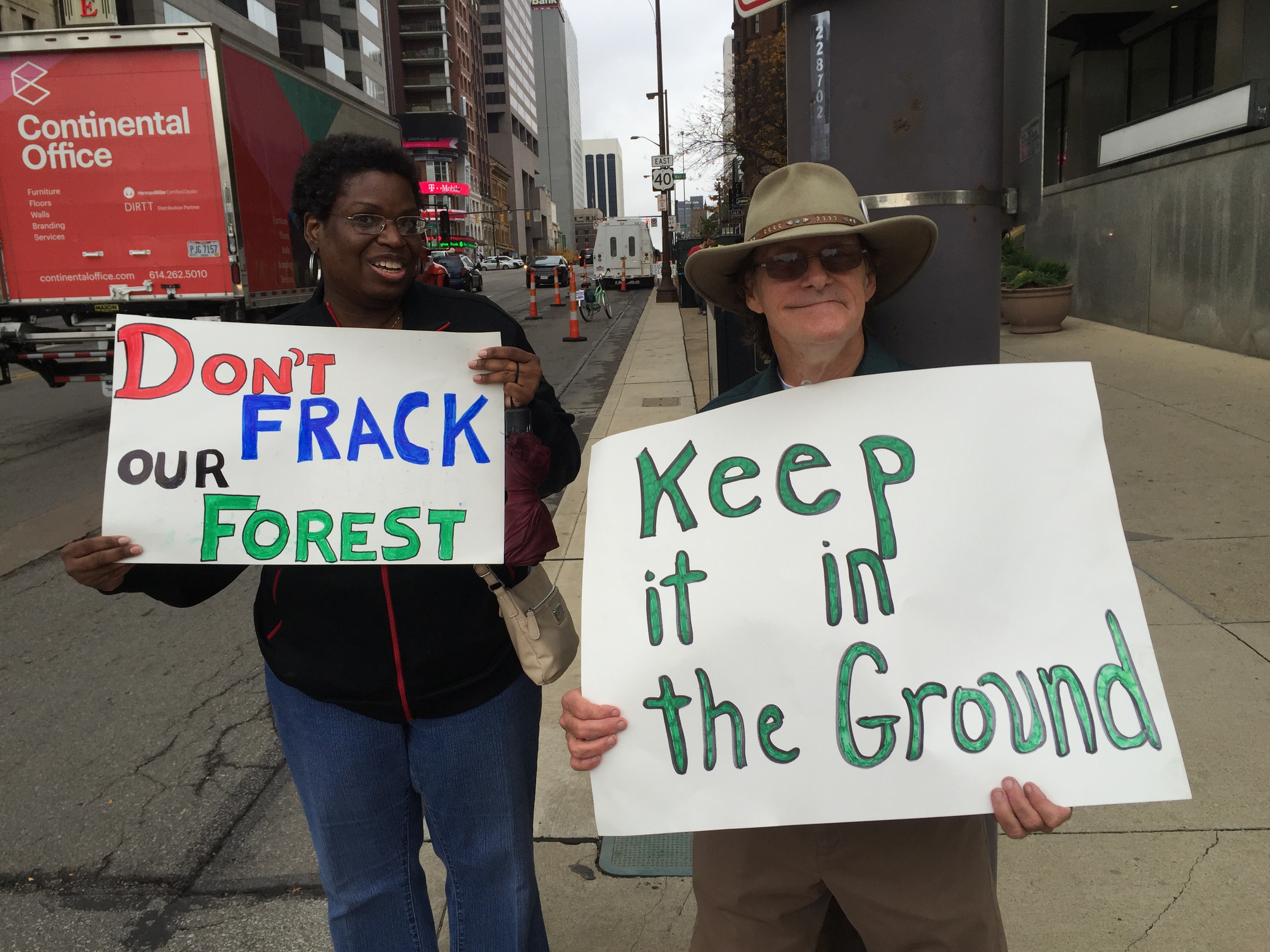
First is climate change. Science tells us that if we want a chance of keeping global warming to 2 degrees C — and the Paris Agreement calls for 1.5 C — we can’t install any more fossil fuel infrastructure. No new fracking, no new drilling, no new pipelines.
To hold warming to 2 C, we can’t put more than 800 gigatons of carbon into the atmosphere, according to a study by 14 organizations for Oil Change International. Yet current oil and gas operations are on track to burn 942 – not to mention the 2795 gigatons of carbon in current known fossil fuel reserves. We must start the transition to renewable energy now.

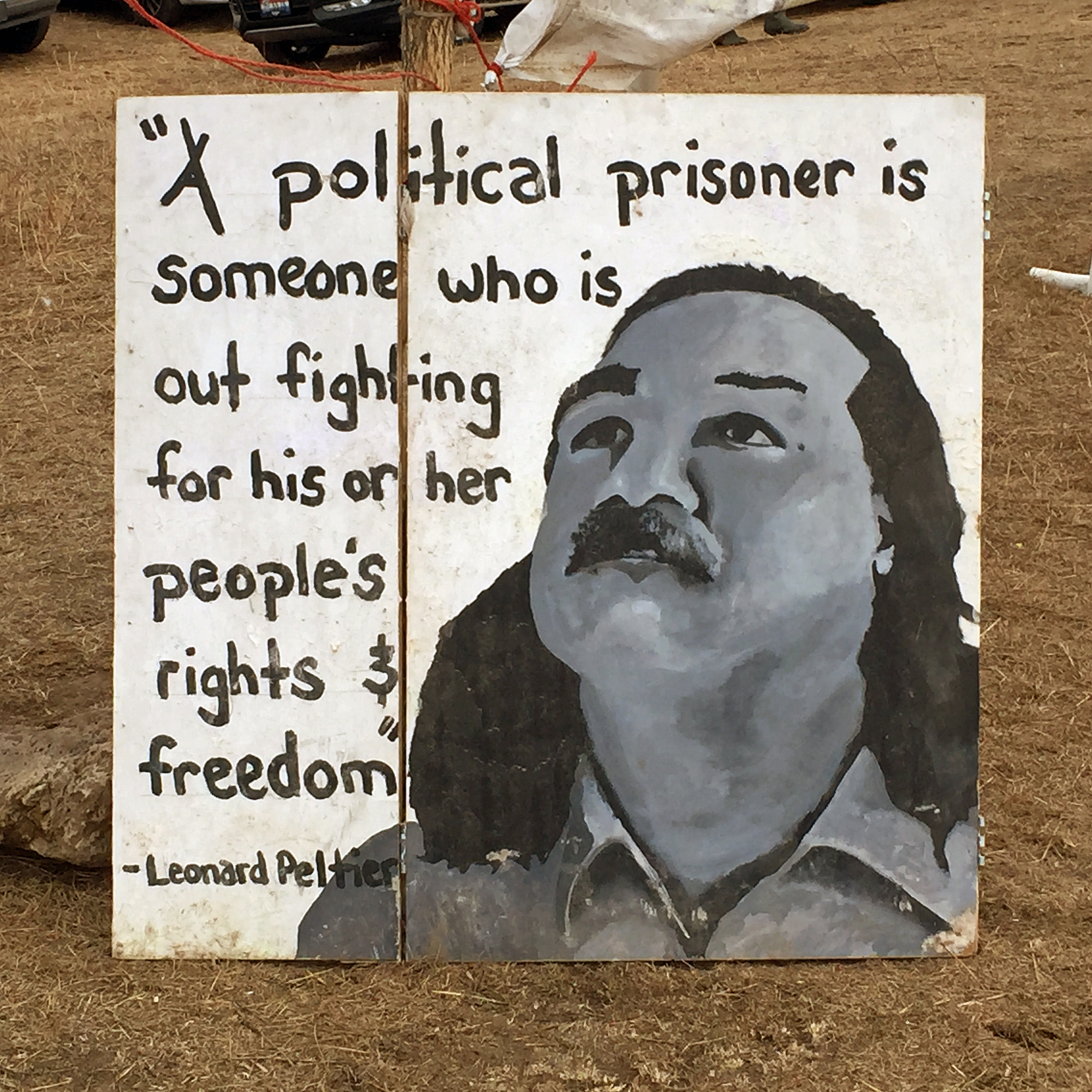
A sign commemorates Native American political prisoner Leonard Peltier
Second is environmental justice. The 1, 172-mile-long Dakota Access Pipeline was originally set to cross the Missouri River just north of Bismarck. However, when concerns were raised about the safety of Bismarck’s drinking water, the river crossing was moved near the reservation. No one thought to ask the same questions about drinking water for the Standing Rock Sioux.
Finally was the question of civil rights. Here was a group of Native Americans simply trying to protect their drinking water – yet the videos of militarized police and security troops cracking down on them were utterly shocking and seen throughout the world via social media.
Militarized police crackdowns
Labor Day weekend was the first time the police brutality toward pipeline protesters – more accurately known as water protectors – broke into the national consciousness. The pipeline company, Energy Transfer Partners, had starting digging up an area the tribe had indicated just the week before was a sacred burial ground.

A water protector waves a flag marking the year Eurpoeans and Native Americans first met.
Water protectors who had gone to the area to hold a prayer ceremony found bulldozers ripping up their ancestral graveyards. When they tried to stop it, they were met by private security guards with attack dogs. Amy Goodman of Democracy Now was reporting on site that day, and got video of the attacks, including dogs with blood dripping from their mouths. Her report was picked up by several mainstream news outlets and seen by 12 million people.
From there the violence by police against peaceful water protectors got worse. Every day water protectors held marches, vigils, and prayer ceremonies. Many of these events were broken up by police. On October 9 Shailene Woodley was arrested as she streamed live to 40,000 viewers on Facebook.
On October 27, police raided the frontline Treaty of 1851 camp, pulling elders out of a sweat lodge at gunpoint and destroying tents and camping materials. More than 140 people were arrested, strip searched, marked with numbers on their wrists, and kept overnight in dog kennels.

A water protector waves at police atop Turtle Mountain.
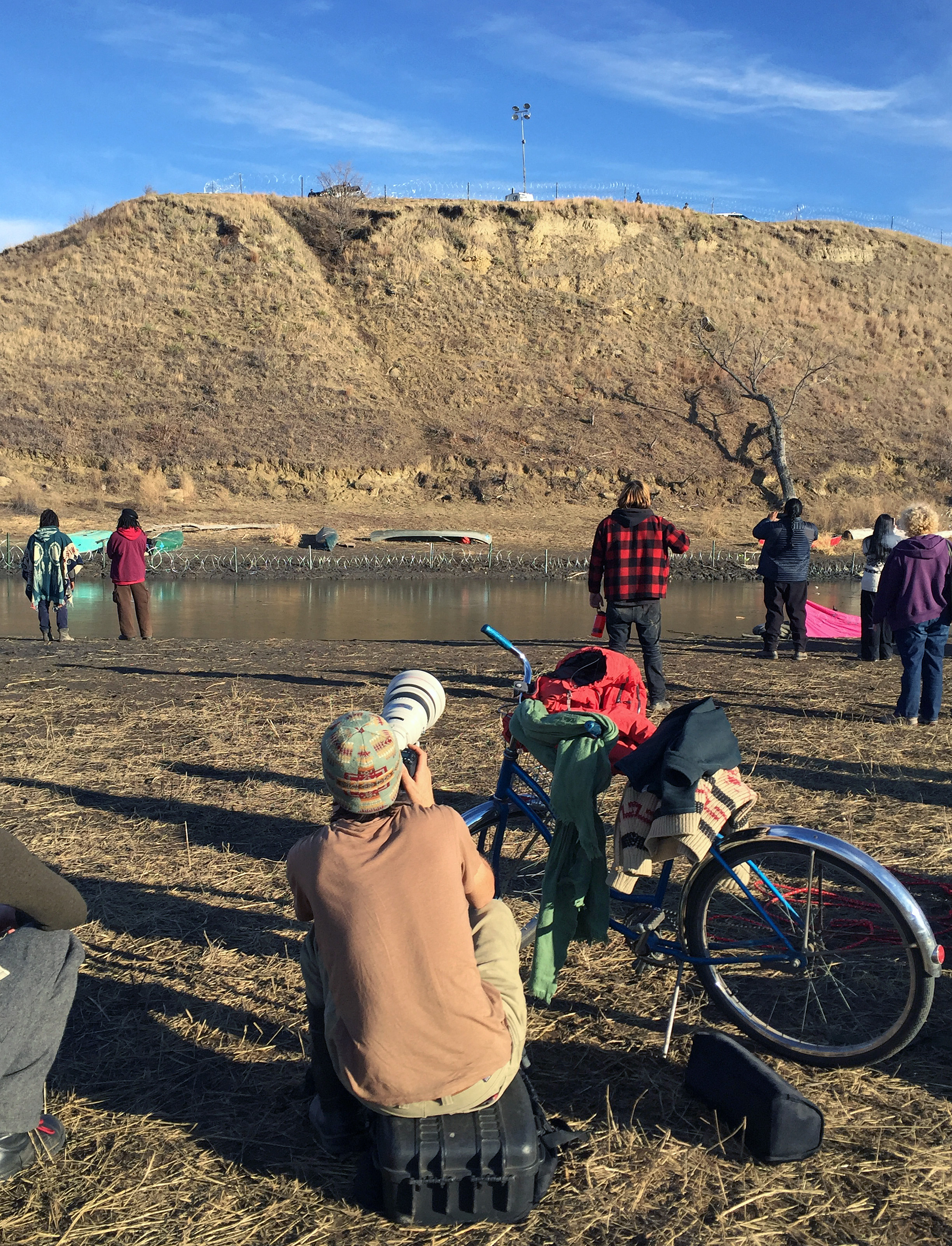
On November 2, hundreds of water protectors were pepper sprayed and beaten with clubs as they tried to cross the Cannonball River to go to Turtle Island, an ancestral burial mound where police had set up a lookout point. Journalists streaming the chaos were shot with rubber bullets in the middle of on-camera interviews.
Then on November 20 was a night of violence that water protectors will never forget. After the October 27 raid, police had erected a road block north of the camp on Hwy. 1806, the main road from the reservation to Bismarck, where everyone went to buy supplies or go to the doctor.
When water protectors tried to move the roadblock, they were met with the kind of force we associate with third-world dictatorships. Police shot flare guns at them, which started fires in the grass. They then used firehoses on the protectors, even though the temperature was only 27 degrees. One woman, Vanessa Dundon of the Navajo Nation in Arizona, was shot in the face with a tear gas canister, blinding her in the right eye. Another woman, Sophia Wilansky of New York, almost had her arm amputated when she was hit with a concussion grenade.
Getting involved
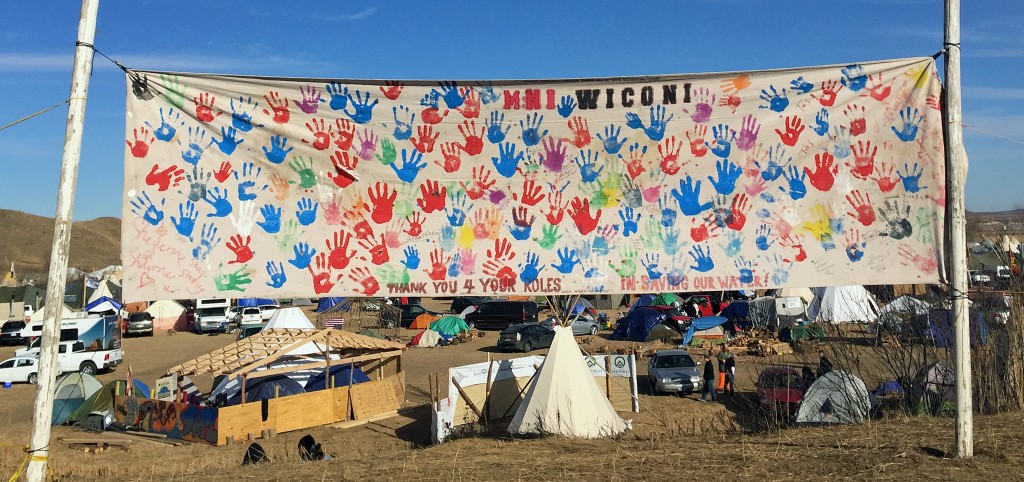
A banner at Oceti Sakowin camp says Mni Wiconi or Water is Life
Watching this story unfold for months on social media– mainstream media either wasn’t covering it or was taking the word of the police for everything – spurred me into action. When pipeline security used attack dogs on water protectors, online activists traced those dogs to a kennel in Ohio, and I filed a formal complaint with the state.
When I read that Ohio sent 37 state troopers to assist with the militarized police crackdown, I started a petition to bring them home on change.org that garnered almost 50,000 signatures. I then accompanied four native American activists from Ohio, along with Ohio Sierra Club Director Jen Miller, to meet with Gov. Kasich’s office.
Throughout I circulated action alerts, petitions, and call sheets for others to get involved as well.
Finally over the week of Thanksgiving, I got to visit Standing Rock. To be honest, after the violence that had occurred the weekend before, I almost didn’t go. But in the end I went, and I’m glad I did because to really understand something, you need to see it for yourself.
Peace and community

My friend Atticus Garden and me near Turtle Mountain.
What I found at camp was very different from the chaos I had seen on social media: a sense of peace, prayer, and community – even among 10,000 people who had never met. It started when I was still in Bismarck. I joined a Thanksgiving Day protest there to highlight the genocide that Thanksgiving had meant for native peoples.
Police had shut off all roads accessing the protest, and cars belonging to water protectors were being towed. I was one of the few people with room in my rental car, so I drove a group of protectors from the San Francisco area back to camp. Even though I had never met them before, I felt an instant kinship as we talked about race, colonialism and oil.
Because the main highway was still closed, it took 75 minutes to drive from Bismarck to Standing Rock via an alternate route. I’ll never forget rounding a corner coming north on Hwy. 1806 and seeing the huge Oceti Sakowin camp spread out in the valley below.

The medic tent at Oceti Sakowin camp
Crossing the Cannonball River to get to camp takes you technically out of the Standing Rock reservation but onto land the Sioux claim as part of the 1851 Treaty of Fort Laramie. Flags of the 300 Native American tribes that stand in solidarity with Standing Rock, lined the highway leading up to the camp entrance, then both sides of Flag Road driving into camp.

Letter to water protectors
Oceti Sakowin camp functioned as a small city. There were roads, gathering spaces, seven kitchens, a medical tent, volunteer tent, media area, tool shop, and clothing tent with enough coats, blankets, pants, shirts, hats, gloves, and so forth to fill a Goodwill store. Although there was no running water, porta-potties were plentiful, reasonably clean, and stocked daily.
That afternoon I had a wonderful Thanksgiving Day dinner at Standing Rock Community High School. Celebrities such as Jane Fonda were there, but they were not the center of attention. Speakers were indigenous people and water protectors themselves. The cafeteria walls and tables were covered with cards and letters of support from children all over the country.
Vision and values
The day after Thanksgiving I attended an orientation in the morning and an action training in the afternoon. Both went well over two hours but were full of information.

The view of camp from Media Hill. Orientation was held in the big white dome.
For orientation I packed into the camp’s big white dome with 200 others, standing toward the back. The speakers went through camp protocols – for example, drugs, alcohol, and weapons were absolutely forbidden so as not to give the police any excuse for a raid. Many protocols were simply to help 10,000 people co-exist peacefully; for example, we were asked to use headphones to listen to music.
Other protocols were specific to native culture; for example, we were asked to stay off burial mounds, and women were asked to wear a skirt even over our pants. I didn’t know to bring a skirt and couldn’t find one at the clothing donations or the nearby casino lodge, so I ended up out of protocol along with half the other women. Next time I’ll know better.
Most of the discussion at orientation centered on the camp’s four main tenets:
- Indigenous centered, or listening to indigenous people, allowing them to speak first, and conforming ourselves to their ways while a guest on their land.
- Build a new legacy beyond racism, colonialism and exploitation of people and planet.
- Be of use, whether helping to chop wood, cook meals, construct a yurt, organize clothing donations, wash dishes, or just pick up trash around camp.
- Bring it home, or taking back experiences and new ways of looking at things with us when we left.

Ribbons tied between flagpoles at Oceti Sakowin camp
Values at camp included prayer, respect, compassion, honesty, generosity, humility, and wisdom. Unfortunately not all non-native visitors had upheld them. One visitor had caused offense by wearing a feather headdress. Orientation leaders explained that headdresses are singular signs of honor and not a cultural icon for non-natives to appropriate. Native peoples very rarely use headdresses even though white cultures constantly depict native Americans as wearing them.
Another group of non-natives had come to Oceti Sakowin camp to party, comparing their experience to being at Burning Man. Oceti Sakowin was definitely not Burning Man. It was a peaceful prayer camp designed to resist the fossil fuel industry and exploitation in all forms, and to build a new community based on equality, sustainability, and peaceful co-existence.
Action training

Hwy. 1806 at Oceti Sakowin camp
The action training was a little awkward given that over 200 people attended. Normally they would have staged a realistic mock action, showing people what to do in case of police violence. Our mock action could not be as realistic, but I did learn about how to prepare for such events from people who had earned their chops during the 1999 WTO protests in Seattle.
- Bring goggles to protect your eyes from tear gas and pepper spray. Large lab goggles can go over glasses, but airholes need to be taped up.
- Bring a bandana or scarf to cover your mouth.
- Don’t show up at an action wearing all these things. You don’t want to look like you are ready for a riot. Just have them in your bag in case you need them.
- Link arms to build a solid wall of people.
- Have water or Maalox on hand in case eye washes are needed, and know how to wash out the eyes of others.
- Write the phone number of jail support on your arms in case you need it.
During the action training, by total chance I wound up standing next to Kenny Myers, who I had met at a climate workshop in Columbus. He was at camp with a group of Ohio people including Max Slater and former Bernie campaign staffer Atticus Garden. They were staying with Benji, a Standing Rock Sioux tribe member who had been there since April.

The flag at Benji’s camp, where the Ohio people were staying.
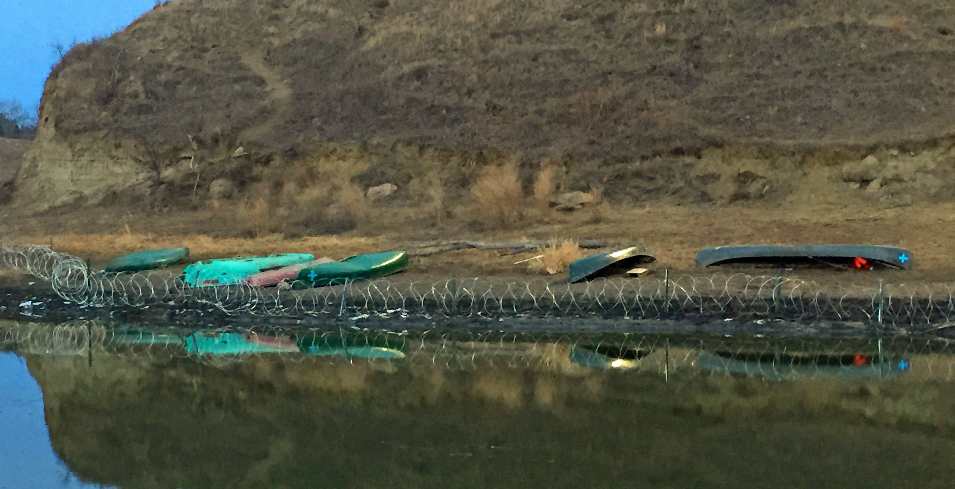
After the action training, Kenny and I went to Benji’s camp, and then the four Columbus people went to see Turtle Island, the scene of chaos on November 2 when police beat back water protectors trying to cross the Cannonball River. Photos from that day showed that some of the officers spraying the crowd with tear gas had Ohio State Patrol insignias on their shoulders.
Just the day before, Atticus had participated in an action in which water protectors laid down foot bridges to cross the river. This time they were successful, and video showed dozens of water protectors at the bottom of the hill while police sprayed water down from the top to freeze the sides so no one could get up. Now, busted-up kayaks were strewn along the base of the hill, and police had surrounded it with razor wire to keep water protectors from crossing onto it again.
After getting some photos, Kenny and I headed to the kitchen area for dinner. Friends who had visited Standing Rock in September described cooking soup in vats over open fires, but by the time I arrived, they had modern ovens on flatbed trucks powered by generators. I had an amazing dinner of eight vegetables and a small piece of salmon.

Busted up kayaks and canoes at the bottom of Turtle Mountain
Afterwards, the four Columbus people headed to an outdoor concert that could best be described as indigenous rap. It was cold outside, but the audience packed together, warming things up. I wish I knew the names of the bands that performed – they seemed to be from all over the country, and all indigenous. The songs centered on colonialism and exploitation of people.
I remember one refrain, “We didn’t cross the borders. The borders crossed us,” about how the lines of indigenous lands keep changing depending on what white people want. The treaty of 1851 had given the Standing Rock Sioux much of the land where the Dakota Access Pipeline was now being built; that treaty had been broken long ago after white people found gold in the black hills. After 500 years, the pipeline was just one more example of broken treaties and colonialism against native peoples, who have a much longer memory of these things than we do.
Prayer ceremony
The next morning, I met my friend Doug Grandt, who I know from Climate Reality training, for brunch. Doug is a retired engineer who once worked for Exxon and now leads the life of a roving climate activist. He had spent several weeks at Standing Rock. Joining us was his friend Peter Anderson, an accomplished photographer who showed us a slideshow of pictures he took on Labor Day weekend when pipeline security attacked water protectors with guard dogs.

Redbud Camp is across the Cannonball River from Oceti Sakowin
Just that morning the Army Corps of Engineers had issued a statement that they planned to close all access to Oceti Sakowin camp on December 5 and were asking water protectors to leave “for their own safety” because winter was coming. We knew the water protectors were not going to go anywhere, so we mapped out how they might still get supplies after the road was closed.

A display at Oceti Sakowin camp points to way to may places
Also affecting the situation was news that 2,000 veterans were going to show up at Oceti Sakowin on December 4. This gathering had already been planned with the purpose of providing support and protection for water protectors against the ongoing violence from police.
After brunch, Peter went to his truck to get a book to recommend to me: Learning to Die in the Anthropocene, by Roy Scranton. Based on a 2013 essay, the book explores the parallels of what Scranton saw as a U.S. Army private during the war in Iraq with what we are seeing from climate change. I ordered the book immediately and hope to read it over Christmas break.
Next I headed to camp. At 2 p.m. was a beautiful prayer circle ceremony planned by a group called Unify, which livestreamed from the scene and had 40,000 people joining in online. The ceremony was held near the foot of Turtle Island. About 300 people got in a big circle, and ceremony leaders came around with burning sage. Then elders came inside the circle and spoke to us about life on earth and why we are here. We ended with 15 minutes of silent prayer.

Keeping an eye on police atop Turtle Mountain
I couldn’t hear everything the elders said, but I remember the number four being important: four winds, four directions, four types of life — rock, water, four-legged creatures, winged creatures. We were told to unify the four parts of ourselves — intellectual, emotional, spiritual, and physical — into one purpose. If we ran around chaotically, the result would be chaos. If we spent our time on frivolous things, the result would frivolous. But if we unify ourselves for one larger purpose, that is what we will achieve.
Before the ceremony started, the police called down to us over their bullhorn from the top of Turtle Island, saying they would “back off and let you have your ceremony if you stop buzzing us with those drones.” Apparently the drones, with their tiny propellers that sound like mosquitoes, drive the cops crazy. The police did back off, but the drones kept flying as normal.
Cast of characters

Bernie supporter Oscar Salazar gets his photo taken near Turtle Mountain
After the prayer ceremony most people left, but I lingered around in the shadow of Turtle Island. A lot of other interesting people did too. I met Oscar Salazar, the millennial who gained fame during the Bernie campaign for wearing a Bernie onesie everywhere. He was still wearing it at Standing Rock. I also met Aviva, a ukulele singer who had performed at the Thanksgiving dinner. She sang “Somewhere Over the Rainbow” to the police.
I also met Jordan Chariton of The Young Turks and TYT Politics, one of the best journalists working today who has spent a lot of time reporting from Standing Rock. Jordan was interviewing actress Frances Fisher, but found some time to get a picture with me.

Me with Jordan Chariton of TYT Politics, one of the best journalists working today
Finally the sun went down, and I walked back to my car to go get dinner at the Prairie Knights Casino Lodge. Sitting on the trunk of my rental and on all the cars around mine were little care packages of cookies and water. I was happy to have this unexpected snack, especially as the sit-down restaurant at the casino had no tables available and the line for the buffet was an hour long.
It was almost 10 p.m. by the time I got food and got out, reeking of cigarette smoke. I decided to go back to my hotel in Bismarck, thinking I could return the next day for a few hours before flying out. But when I woke up the next day, I was really sick and didn’t have the stamina for another round trip. Instead I caught a showing of Arrival and flew home.
Forgiveness and victory

Oceti Sakowin camp from Hwy. 1806. Red Fawn is a water protector arrested on October 27 and still being held by police.
It was a very quick trip to Standing Rock, and I wanted very badly to stay longer. A week after I got back, 2000 veterans led by Wes Clark Jr. and Michael Wood began arriving at Oceti Sakowin. That same day, the Army Corps of Engineers finally issued its decision about the easement for the Dakota Access Pipeline to cross the Missouri River: The easement was denied for that location, and any other location would need a full Environmental Impact Statement.
Even more thrilling, on December 5 was a ceremony in which Wes Clark Jr. on behalf of all the veterans who had come to Standing Rock asked for forgiveness for past injustices the military had committed against Native Americans. Among Clark’s remarks:

Child’s letter to water protectors
“Many of us, me particularly, are from the units that have hurt you over the many years. We came. We fought you. We took your land. We signed treaties that we broke. We stole minerals from your sacred hills. We blasted the faces of our presidents onto your sacred mountain. When we took still more land and then we took your children and then we tried to make your language and we tried to eliminate your language that God gave you, and the Creator gave you. We didn’t respect you, we polluted your Earth, we’ve hurt you in so many ways but we’ve come to say that we are sorry. We are at your service and we beg for your forgiveness.”
TYT Politics interviews actress Frances Fisher about Standing Rock
It was an amazing end to a nine-month saga in which the struggle of this tribe had gone from obscurity to worldwide sympathy and support. I felt privileged to have seen the Standing Rock Reservation and Oceti Sakowin camp at its height. Doug, Peter, and I had talked about how the camp evolved over the months and could easily grow into a permanent settlement.
However, I don’t know if that will happen. As soon as the decision denying the easement was announced, a major blizzard hit the area, and tribal chairman David Archambault II asked all non-native water protectors to go home. Most of them did when they were able to leave.
For its part, Energy Transfer Partners has vowed to continue pipeline construction, convinced that the Trump administration will reverse the denial of the easement. However, Kandi Mossett from Indigenous Environmental Network says Trump can’t simply reverse this order, and will still have to do the full Environmental Impact Statement. She believes the Standing Rock Sioux got exactly what they asked for, and counts the denial of the permit as a major victory.
Blueprint for hope

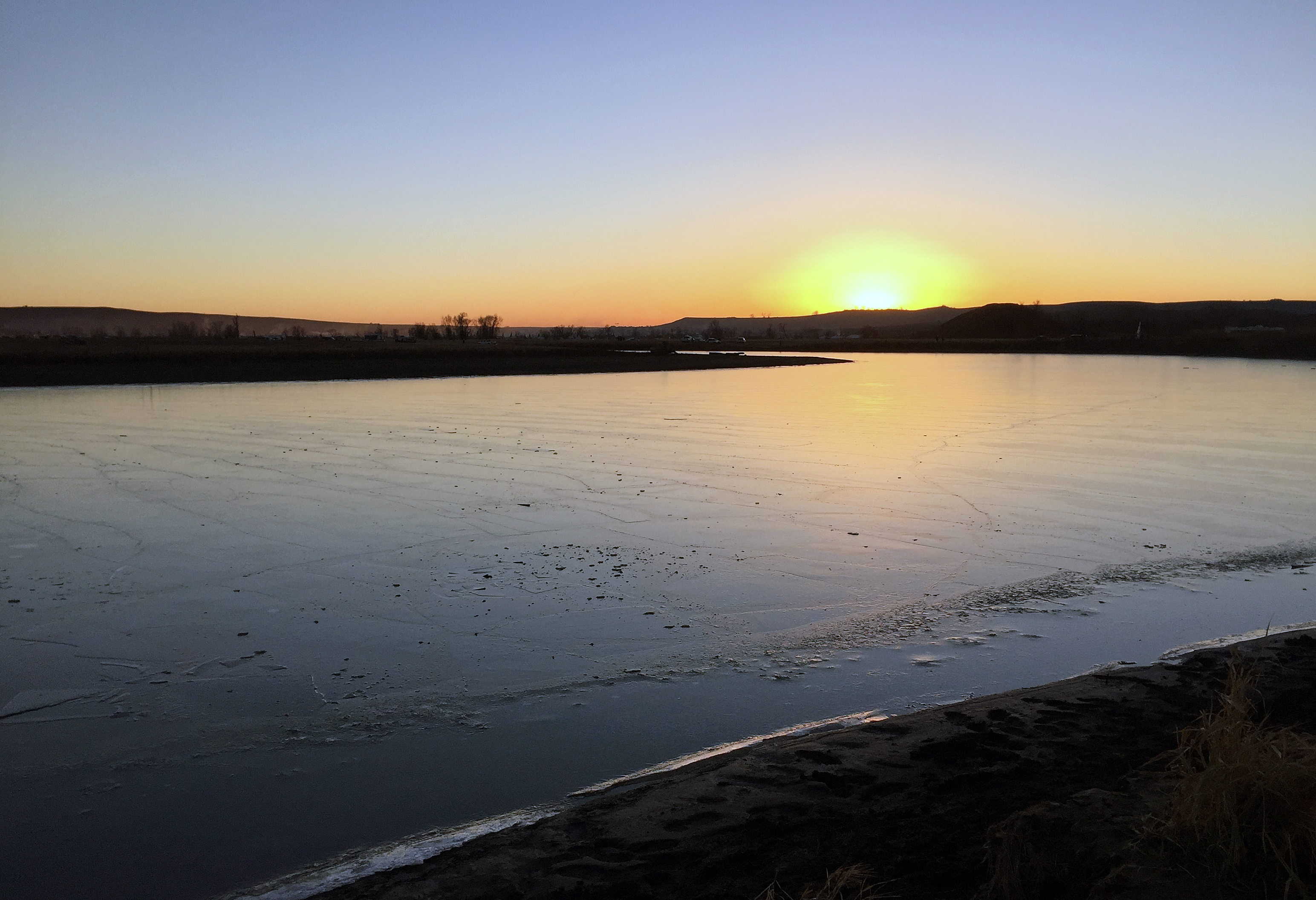
Sunset on the Canonball River
Ultimately the story of what happened at Standing Rock is one of great hope. Despite the fact we have a fossil-fuel president taking office in January. Standing Rock provides a blueprint for how to fight this form of exploitation. Water protectors stayed peaceful and united no matter how much violence was used against them, and just as in the Indian independence movement of the 1940s, civil rights movement of the 1960s, and anti-apartheid movement of the 1980s, peaceful water protectors won the hearts, minds, and support of people all over the world.

Teepee at night
Indigenous people everywhere are at the front lines of the climate fight. We’ve seen it in the resistance to the Tar Sands in Canada and drilling at Yasuni National Park in Ecuador. This fight has now come to the United States. Indigenous people are the right people to lead the fight against fossil fuels and the way to a sustainable and just transition to clean energy.
Indigenous people know better than anyone else how to live in peaceful co-existence with nature. They have also borne the external costs of fossil fuel exploitation most directly. My trip to Standing Rock showed me how exploitation of the earth goes hand in hand with exploitation of people, and that we need a new relationship not just with nature but with each other.
For 500 years our country has not addressed its history built on the genocide of native Americans. We need to — for their sake, our sake, and the sake of the environment we all share. As we move forward in seeking action on climate, let us not forget the people who bear the greatest costs, so we can figure out how to transition most equitably to a new world.