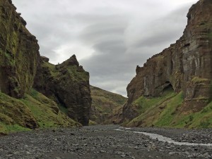
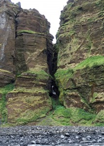
Stakkholtsgjá gorge at Þórsmörk
Today we visited Þórsmörk (pronounced “thors-mork”), or “Thor’s woods,” named after the Norse god Thor. Njáls saga, considered the greatest Icelandic saga, took place in this and surrounding areas. A lot of landmarks are prominent, such as Einhyrningur, or Unicorn Mountain, a large rock with an outcrop that looks like a unicorn’s horn.
On the way we stopped at Seljalandsfoss. The falls are a popular spot with a lot of tour buses. They are notable because people can walk behind the waterfall for photos. Many weddings are done in front of the falls. I took the stairs and path behind the falls and got some good pics and video.
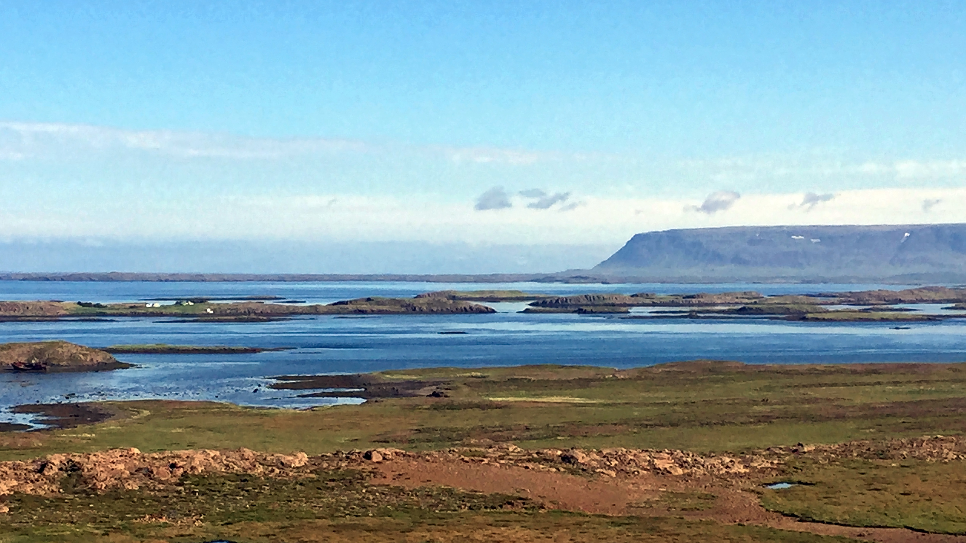
Þórsmörk is surrounded by three glaciers, which is what gives the area its power – Mýrdalsjökull, Eyjafjallajökull, and Tindfjallajökull. The first two glaciers come together in a V that marks the heart of Þórsmörk . This area holds the Markarfljót river, which is really a series of glacial streams that eventually merge. Every year these streams expand from glacial melt, so you can see a lot of levees and earthworks to try to control the river from moving and flooding. There is only one small gravel road with no bridges, so the bus forged through the streams of Markarfljót directly several times. I was amazed that the bus could make so many stream and river crossings successfully, but it did.
Towering over us were the Mýrdalsjökull and Eyjafjallajökull glaciers. Eyjafjallajökull (pronounced “A-ya fiat-la yo-kult“), contains a volcano that erupted in 2010. The ash grounded air traffic for weeks. Mýrdalsjökull contains the Katla volcano, which is overdue for an eruption. Its normal period is period is 80 years, but the most recent eruption was 1826, almost 100 years ago. Katla also usually erupts shortly after Eyjafjallajökull, so Icelanders expect into happen anytime. When it does erupt, it will fill the valley with melted ice, which is why the Markarfljót river fills so much of the valley.
Mýrdalsjökull glacier at Þórsmörk
Lupine is growing throughout them area. Dr. Slater told us he was here in 2011 with people from the Soil Conservation Service. They were trying to eliminate the lupine because it is considered invasive. They came in with huge sprayers and blanketed slope with roundup – but the lupine is still growing so they were not very successful.
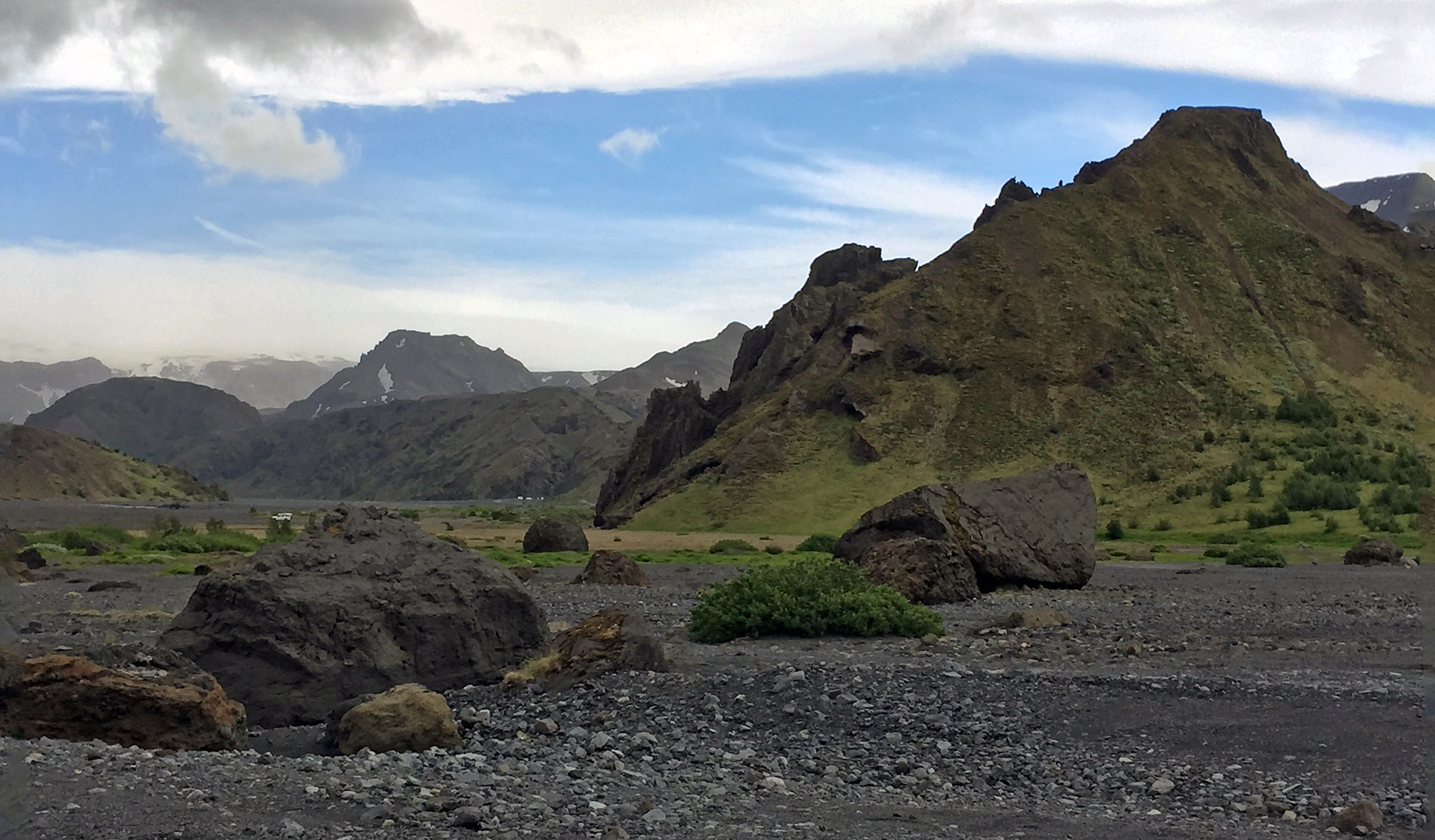
Boulders in the Þórsmörk valley
As we drove into Þórsmörk, we could see large boulders all over valley. Dr. Slater said they resulted from the collapse of a hill slope in January 1967. Tons of rocks collapsed, turning all the ice around them into a slurry of fast moving water. The water took little pieces away, but dropped the bigger rocks here. Fortunately it was the dead of winter, so no one was around at the time.
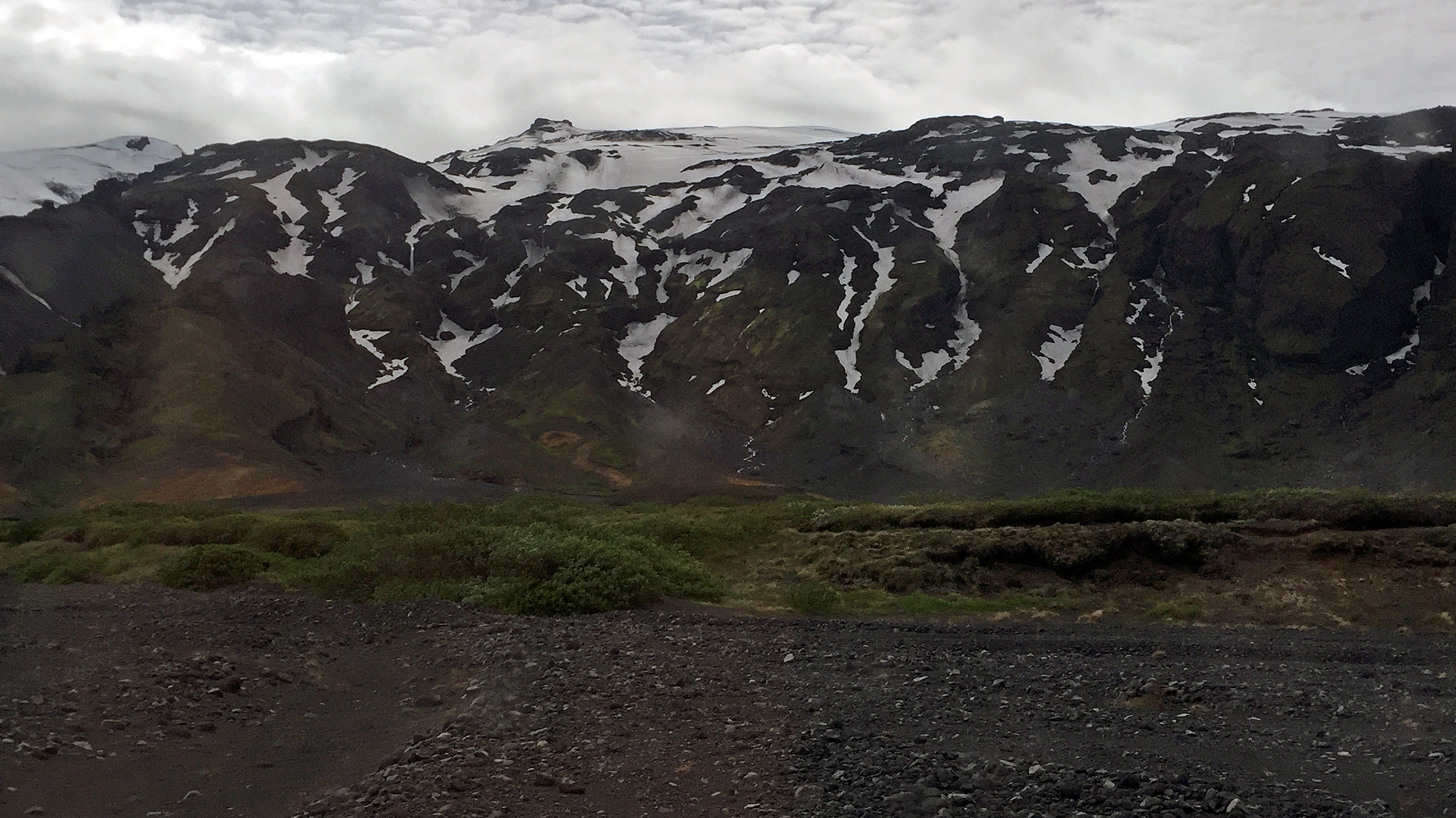
We did two hikes. The first was to see a glacier up close: the Eyjafjallajökull glacier with the Gígjökull glacial tongue hanging down. Eyjafjallajökull is the Icelandic volcano that erupted in 2010, stopping air traffic across Europe for several weeks. It was a long hike up and down through pebble sand to the glacier. Aw we approached, we heard water running. First we saw water seeping out of the side of the mountain, then a stream coming through a fissure in the rocks. Finally after rounding a large hill, we saw the Gígjökull glacier tongue with a river flowing in front of it.

Eyjafjallajökull glacier on top with Gígjökull tongue handing down

Ice cave at the bottom of the Gígjökull glacier
Several of the other students crossed the river to go to the bottom of the glacial tongue which formed an ice cave. Their forms were so small compared to the ice cave, which itself was small compared to the Gígjökull glacier, which was just an offshoot of the Eyjafjallajökull glacier above. Yet the entire area is melting. On the way out we saw photos of what the glacier looked like before and after the eruption. The glacier was much larger before the 2010 eruption, which took out a lot of ice – but even so the glacier was noticeably smaller now than when last year’s trip visited visited in August 2015.

Stakkholtsgjá gorge at Þórsmörk
The second hike was through the Stakkholtsgjá, a huge green canyon that leads to a waterfall. As I walked through, I could not help but think about the passages in the Book of John about God separating the heavens from the earth during the creation. I’m not a very religious person, but I ended up talking to Susie and Bjork, our cook who accompanied us from Agricultural University, about religion. It was impossible not to feel the power of the planet and how small humans are in comparison. Yet humans are also shaping the earth by causing the glaciers to melt and many other things. I was reminded that if the glaciers around Þórsmörk melt away, then the entire area will die.

Sign to hiking trails and the all important bathroom.
On the way to our overnight accommodations at the Þórsmörk volcano huts, we had to cross yet more streams. One of them was particularly large, and our bus driver Sigthor did not think we would make it. Weather was starting to roll into the area, so even if we made it across tonight, there was no guarantee we would make it back tomorrow. We turned around and ended up in a camping area for a couple of hours while waiting for a bigger bus. I found a bathroom and walked around outside for a bit.
Then we repacked to take just one night’s supplies and leave our big suitcases behind. Finally the new bus arrived, a huge bus from Reykjavik, and got us to our destination safely. We locked up our smaller bus and left it out on the gravel between glacial streams of the Markarfljót river to be picked up the next day. Somehow everyone knew it and our luggage would be fine — and it was, though it looked awfully small in the backdrop of the Þórsmörk gorge.

Hiking trail map
The volcano huts were a series of camping spots, small cabins, and larger cabins. At the center was a restaurant plus a building of showers and a kitchen for the campers. Several popular hiking trails come through this area, including Fimmvörðuháls, a 14-mile trail at 3,300 feet between two glaciers and a volcano. Our entire group was in one of the larger cabins, with the women in one room of bunk beds, the men in another. I got a top bunk. Bjork roasted a leg of lamb for dinner for most people, but I had the veggie burgers and salads, which were delicious, and went to bed early.
Here are some more photos from the day. Click on any photo to enlarge it.
-

- Seljalandsfoss
-

- Seljalandsfoss
-

- Seljalandsfoss from behind
-

- Seljalandsfoss from side
-

- First view of Mýrdalsjökull
-

- Eyjafjallajökull tiny stream
-

- Eyjafjallajökull larger stream
-

- Gígjökull ice cave
-

- Gígjökull ice cave
-

- Þórsmörk sign
-

- Þórsmörk valley boulders
-

- Þórsmörk valley boulders
-

- Mýrdalsjökull in clouds
-

- Entrance to Stakkholtsgjá
-

- Stakkholtsgjá
-
- Stakkholtsgjá
-

- Stakkholtsgjá
-

- Stakkholtsgjá
-

- Stakkholtsgjá
-

- Stakkholtsgjá rock
-

- Stakkholtsgjá rock
-

- Stakkholtsgjá cave
-

- Stakkholtsgjá cave
-
- Stakkholtsgjá
-

- Big bus comes to our rescue
-

- Packing up the little bus
-

- Þórsmörk formation
-

- Þórsmörk formation
-

- Þórsmörk formation
-

- Þórsmörk formation