The Department of Geography welcomes Yaoli Wang – a post doctoral researcher – and Yu Liu – a full professor – from Peking University, providing a guest post during the COVID-19 outbreak.
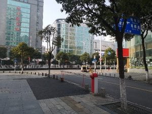
The Spring Festival of 2020 was determined to be historic. One week before the Chinese New Year Eve (Jan 24), Beijing public transport tubes were still in hustle and bustle like usual. Within four days, the outbound flow back home from Beijing made the city quiet, when the news came clearly to everybody that a SARS-like virus has struck Wuhan. At 10 am, Jan 23, 2020, Wuhan was forced into lock down. Things evolved rapidly from there. Until the time of quarantine, 5 million people had left Wuhan. Along with the flow of migration was the spreading of a very contagious and novel coronavirus – COVID-19. All Chinese provinces and many worldwide countries reported infections. People, however, always have normalcy bias, inclining to believe that nothing bad will happen to them and thus not careful enough. The outbreak worldwide is already good proof.

Lockdown of Wuhan in January (Courtesy of Professors Qingyun Du and Zhixiang Fang, Wuhan University)

Lockdown of Wuhan in January (Courtesy of Professors Qingyun Du and Zhixiang Fang, Wuhan University)
Underneath the accident is essentially a spatiotemporal problem. Within China, the problem can be divided into two scales: inter-city and intra-city. Now in late February, geospatial scientists are trying to reverse the course of COVID-19 spread over China using inter-city movement flow and city-level reported confirmed cases in time series. We would imagine a spread dynamic like wavefront and wish to construct a model of migration interaction based on which the arrival time or amount of illnesses can be inferred. The lock down of Wuhan apparently put a brake on the spreading process, but could not eliminate it. Already infected people outside Wuhan continued to transmit the virus to other cities or within their own cities. The hierarchy of the interaction network potentially captures the spreading path, which indicates an effective interruption. Here we see the huge potential of space-time big data. There is a study at the beginning of the outbreak which, by analyzing the outbound movement flow from Wuhan to areas around, drew a conclusion that the up-till-then reported illness count was underestimated 1; the conclusion, unfortunately, was proven to be true when the statistics were complete.

Figure 1: Spatial distribution of the confirmed COVID-19 cases in China on February 17, 2020, when the total number is 72,528 [2]
Foreseeing the future of urban life and technology, can we imagine a world where every person is implanted with a chip – something we call “human black box” recording all the information throughout life, including his (or her) health, spatiotemporal trajectories, habits, etc? What’s missing is a mature mechanism to protect privacy and data safety. Blockchain might be a potential solution. All the information is not controlled by a central organization. The owner of data has the initiative of data-sharing in an urgent case like the outbreak of coronavirus. As an incentive of sharing data, the user gets bonuses, which is guaranteed by a blockchain system. We believe that most people are not ready for accepting such a technique at present. But could this become reality if we can manage the negative issues, say, 100 years later? Let’s wait and see.
The virus is still happening and boosting technology innovation. City governance needs a more robust system to be responsive to public events; e-commerce is evolving to smooth the channel between suppliers and customers; education is developing new patterns such as online education; crowd-sourcing and public participation is driving for social well-being. Up until the time of writing, many countries all over the world have reported infections, but many of them cannot trace back to the origin of infection. Potentially the geography of virus genomics may map out the trajectories of generations of virus so that we can disclose the mystery of its origin and spreading. All the aspects can be regarded as evolvement of spatiotemporal relationships. We are going for an opening-up of geospatial technologies.
Yaoli Wang (Post Doctoral Researcher), Yu Liu (Professor)
Institute of Remote Sensing and Geographical Information Systems,
Yu Liu is the 2019-2020 Robinson Colloquium speaker for the Department of Geography.
- https://mp.weixin.qq.com/s/8x8UYZBZwMGn86Wq7iz4og, in Chinese.
- https://vis.ucloud365.com/ncov/china/en.html
Post has been updated (4-2-2020) with photos from contributors of the author