Maps have always played a significant role in conducting a census. This post discusses map production within the Geography Division of the U.S. Census Bureau to support the 2020 Census.
Although most of the field operations for the 2020 Census were conducted on digital instruments rather than paper, there is still a need for paper maps to support many operations. For instance, staff in the area census offices (ACOs) use large-format paper maps to help understand and visualize the boundaries of the collection geographic areas within their ACO or to visualize the workload for a particular operation. Other operations, such as Remote Alaska, Update Enumerate, and the Island Areas Census, are conducted entirely on paper. In these cases, staff use small-format maps to locate their workloads and annotate updates in the field.
In order to provide the number of maps required for geographic programs and field operations under strict production timelines, the Census Bureau utilizes the Census Automated Map Production System (CAMPS). CAMPS is automated mapping software that runs in a batch environment. CAMPS was developed in the lead up to the 2010 Census and continues to be a major part of production mapping. Cartographers design maps by setting up project parameter tables that describe everything from the title that will appear on a map to the appearance of labels and features for each feature class that will appear on a map. During peak operations, CAMPS creates thousands of map sheets per hour. For example, for the Local Update of Census Addresses Operation (LUCA), CAMPS created more than 800,000 unique map sheets over an 11 day period!
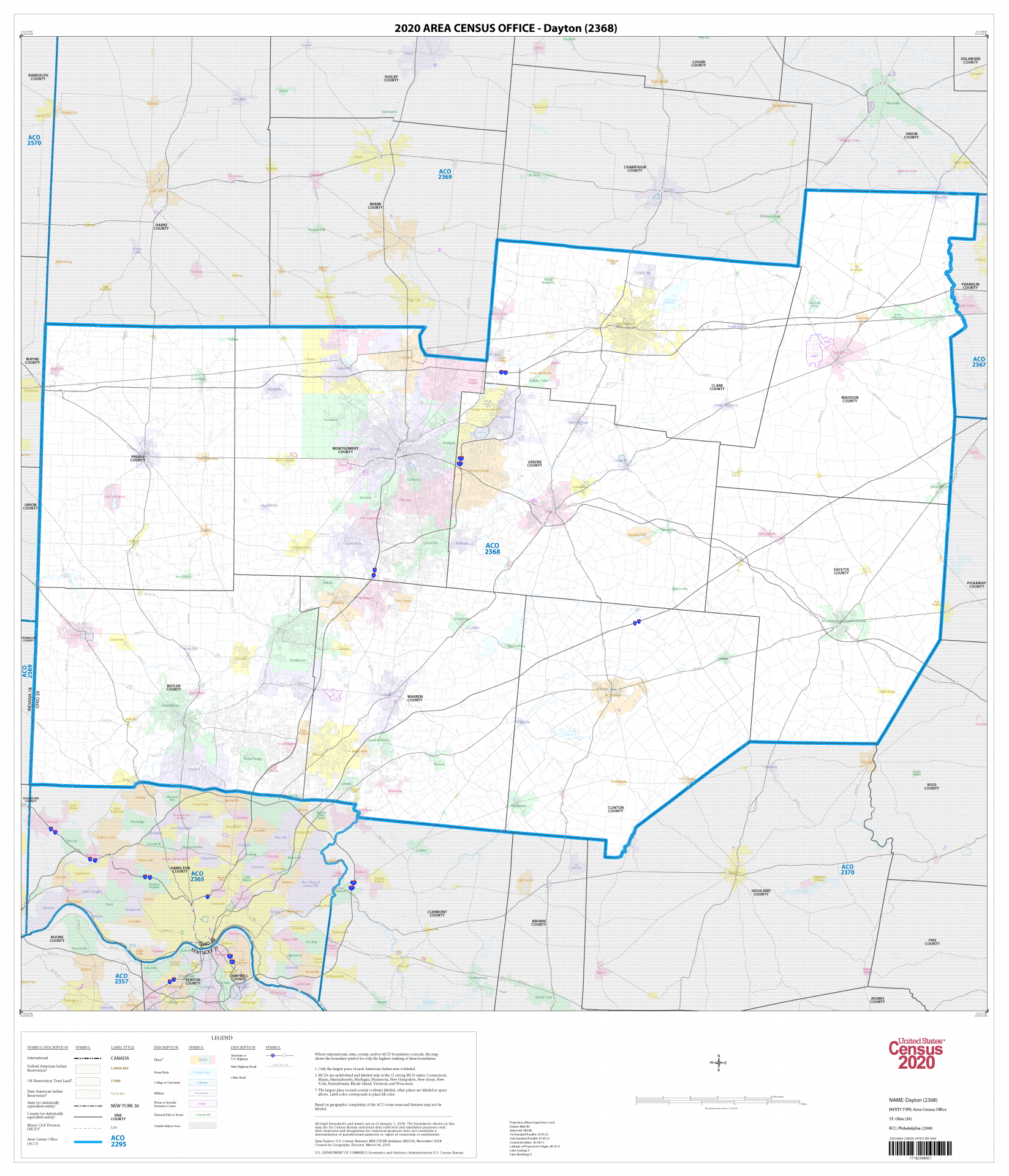
Largely due to the digital nature of many 2020 Census operations, most operations requested that we create large-format maps on as few sheets as possible, preferably a single sheet for each mapping entity. This presented some design challenges as CAMPS traditionally scales maps to as many sheets as needed based on the density of a particular geographic type within the subject area. Due to the large variety of the sizes of the subject areas for some map types, we designed multiple scale-dependent parameter configurations for each map type. Figure 1 shows a map of the Dayton ACO. This map was created in CAMPS and identifies the boundaries of the ACO. This map type included maps with scales as small as 1:1,000,000 and as large as 1:11,000 for the ACOs in the contiguous U.S.
Although we created the vast majority of our 2020 Census field maps in CAMPS, we also used commercial mapping software to produce maps, using manual interactive design and scripting. We designed map document templates in the commercial mapping software and developed scripts to automate the creation of the maps. For the Island Areas Census, we created approximately 5,600 basic collection unit (BCU)-based maps with imagery. Figure 2 shows an example of one of these maps in Guam, which was used in the field along with additional small-format maps to conduct the Island Areas Census.

Web maps and web map applications have also become a large part of our work for the 2020 Census. Web maps are particularly valuable for the communication of 2020 Census concepts to the general public and our partners. We developed web map applications to aid in outreach efforts in hard-to-count communities with the Response Outreach Area Mapper and to indicate how the Census Bureau planned to conduct the census with the Type of Enumeration Area Viewer, the In-Field Address Canvassing Viewer, and the Mail Contact Strategies Viewer. We were able to communicate with the public about the participation of local partners in programs such as LUCA, the Participant Statistical Areas Program, and the New Construction Program. In addition, we found the web map applications to be useful for the internal tracking of the status and progress of programs.
We are currently planning and developing maps and cartographic products for the next phase of the 2020 Census: data dissemination.
Kevin Hawley is an OSU alumnus and chief of the Cartographic Products and Services Branch in the Geography Branch at the U.S. Census Bureau. Any views expressed are those of author and not necessarily those of the U.S. Census Bureau.
You can see more of Kevin Hawley’s important work and its basis in Geography below.