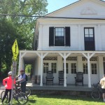
Last week, I had the pleasure of biking the Ohio to Erie Trail with fellow geographer Michael Widener and his friend Farooq Khan. The Ohio to Erie Trail is a 350 mile bike trail between Cleveland, Columbus and Cincinnati that is about 85% complete. We did it north to south over five days, with a rest/tourism day in Columbus. Here is a link to my GPS trace of the ride posted at RidewithGPS: Ohio-to-Erie Trail June 2014
It was a lot of fun and really made me appreciate the diversity of my native (and recently re-adopted) state. The physical and human landscapes ranged from post-Industrial, Amish/Mennonite farms and towns, hilly Appalachia, Midwestern agriculture, and Southern river valleys and town. Very green and beautiful. There are some unique cultural features, for example this dual purpose trail in Holmes County (the heart of Amish country):
We also made a side trip to Yellow Springs, Ohio: a small slice of Berkeley in rural southwest Ohio – well-worth a visit (and perhaps a night’s stay, since the lodging options in Xenia are lacking). Again, Ohio is more diverse than you think.
The Ohio-to-Erie trail mostly follows old canal and railroad paths. The grades are great for biking, but it is also like riding though a transportation museum (especially Cuyahoga Valley National Park between Cleveland and Akron): you can see remnants of the old canal and railroads, and the old towns created by them. These transportation corridors have been supplanted by road and highways that are less respectful of the surrounding terrain. It is a very different experience than driving.
What I found particularly heartening was the potential for Northern European-like bike tourism in the United States. Some of the towns along the trail are re-inventing themselves based on the new Lycra wave – in some cases, for the third time (first canal, then rail, now bicycles)!
You can already see the bike tourism potential in the places along the Ohio-to-Erie trail with the most developed bike infrastructure. For example, here are some pictures of Boston Mills, Ohio in the Cuyahoga Valley National Park – once a canal town, now a bike town:
Akron, Ohio – a canal town before it was Rubber City – also has a nice downtown canal-oriented park with restored buildings:
Other towns are also making the most out of the bike trail. Here is Canal Fulton, near Canton, Ohio – a very pleasant park with a lot of activity on a fine summer day:
Many towns along the trail recognize the potential for tourism, such as Cedarville (southwest of Columbus):
And there is Loveland (north of Cincinnati) that has achieved a European level of bike-oriented facilities and services (including a trailside cafe that offers fine Rhinegeist beverages for carbo-loading):
In general, you see better bike infrastructure and consequently bike traffic and bike-related services in southwest Ohio than northeast and central Ohio. The cities of Xenia, Dayton, Springfield, London and Cincinnati are well-connected by a regional bike trail network (although Cincy needs to extend its trail to the downtown). Xenia has emerged as a hub in SW Ohio bike trail network; I hope this leads to better lodging options (see comment above about Yellow Springs).
I hope to see more bike infrastructure development in Ohio, including the interconnection of the Columbus Greenways system. It really doesn’t cost that much (way cheaper than building roads), and the potential tourism benefits are great. I think that interconnecting the Columbus Greeways system and connecting it with the Ohio-to-Erie trail could make Columbus a bike tourism mecca. Ka-ching!*
*Old-fashioned cash register noise.


