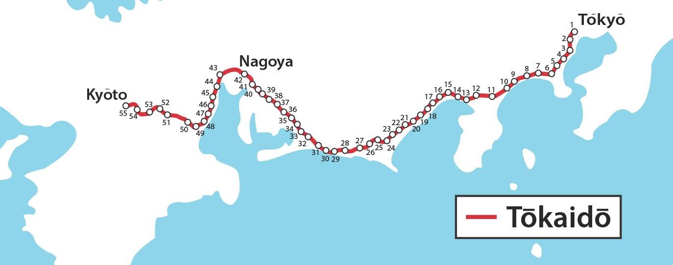
To show change over time and compare cultures as well as learn more about a very important part of Japanese history and culture, the “Journey along the Tōkaidō” has been created using various primary source materials. The Tōkaidō Road, from Tokyo to Kyoto in Japan can be examined at various time periods (1830s, 1920s, and present day) and will show comparisons to the U.S. National Road and Route 66. The stations along the Tōkaidō Road can looked at two ways: “horizontally” across the many stations in one time period, or looking “vertically” at one station across several time periods.
Students will study two primary source materials: the Tōkaidō gojūsantsugi manga emaki (The Fifty Three Stations of the Tōkaidō Manga Scroll, which will be referred to as the “Tōkaidō Manga Scroll”) and the The Fifty-Three Stations of the Tōkaidō woodblock prints. This Tōkaidō manga scroll was created by 18 members of the Tokyo Manga Association during a trip approximating the route of the old Tōkaidō in 1921 and depicts scenes of Japanese culture, history, economics, daily life, transportation, architecture, and industry. Utagawa (Andō) Hiroshige’s The Fifty-Three Stations of the Tōkaidō (1833–1834 in the Hōeidō edition) is a series of woodblock prints (ukiyo-e) of the stations along the Tōkaidō. These ukiyo-e prints became enormously popular and have been reprinted countless times down to the present. Lesson plans align to the state standards of Ohio. Funding was provided by the Japan Foundation Center for Global Partnership and the Institute for Japanese Studies at The Ohio State University.
“Journey along the Tōkaidō” resources:
- Ukiyo-e Woodblock Prints (1830s)
- Tōkaidō Manga Scroll (1920s)
- Present Day (2020s)
- Tōkaidō Station Summary
- Maps
- US Route 40/Route 66