Geological Exploration & Discovery Activities
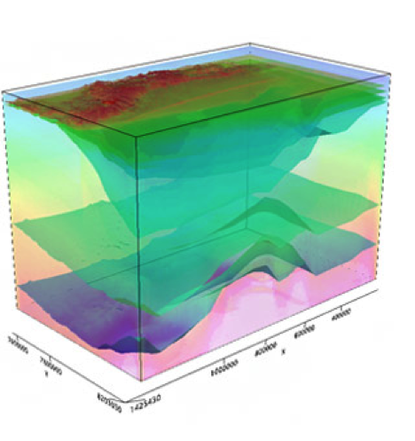
Picture of seismic images produced to determine rock formations beneath earth’s surface.
When it comes to exploration of crude oil resources, there are many different methods that petroleum geologists and geophysicists use to discover them. These include:
- Gravity Survey: a gravity reader (gravimeter) measures the gravitational pull in certain rock formations to determine what could lie beneath the surface. The gravitational pull is measured in what are called “milliGal.” On earth’s surface, the typical measurement of a rock formation that does not contain oil reserves or minerals is 980,000 milliGal; however, a rock formation with a crude oil reserve would rarely measure above 300-400 milliGal. This type of survey is simple, fairly cheap, and non-invasive, making it useful in highly populated areas. It is typically and most accurately done on the ground, but can also be done from the air or on a boat for reading hard to reach areas and underwater.
- Magnetic Survey: magnetic reader (magnetometer) is usually flown on the back of an aircraft in order to detect whether certain rock formations have magnetic anomalies, which can indicate an oil reserve at certain levels of a magnetic reading. This type of survey is especially useful in hard to explore areas, like mountainous regions.
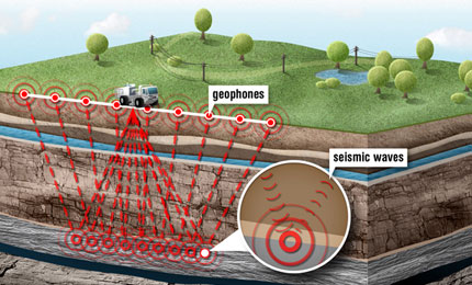
- Seismic Reflection Surveys: a seismograph is used underground, but operated from above ground. The shallowest depth at which a seismograph can be used is 3-5 meters. There are quite a few methods that geologists and geophysicists use to operate a seismograph to detect petroleum, but the most effective methods use geophones, which is a device that converts ground movement into voltage in the form of waves that a seismograph can read. Seismic Reflection Surveys are not as useful as gravity and magnetic options, as it is invasive into the ground, more costly, and far more complex.
- Exploration Drilling: there are several methods for exploratory drilling, but they include drilling anywhere from a half of a mile to three miles from known reserves to determine if there are reserves nearby. This method is usually higher risk, as it is more costly and does not rely on much data collection beforehand. This does not rely on data without drilling, so it is generally more useful in areas that are not populated.
- Visual oil seeps: it’s just what it sounds like–visual evidence of an oil reserve. This can include topographical visuals, bubbling, upwelling seawater, and many others. This can be a negative and positive. It is cheap because it requires no equipment, but it can indicate harm to wildlife or water supplies depending on where these seeps are found.
These methods provide valuable data of what kind of rock formations lay below the ground. This data is then analyzed to determine if the formations are favorable for the presence of crude oil. Once favorable rock formations are discovered, exploratory drilling is done to determine whether or not the petroleum is present and, if so, how large the reservoir is. The process of oil exploration requires a license and is a very expensive process, but it can pay off when large reservoirs are found.
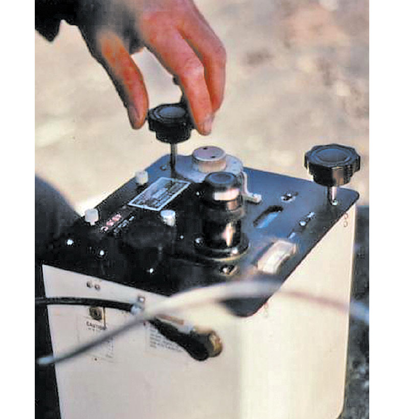
Land gravimeter
Critical Investigation: Why & How
This is a crucial part of the process of getting gasoline into our cars, as it must be discovered before anything else can happen. However, the concern that arises is the environmental impact. While options like gravity and magnetic surveys lessen any environmental damage, seismograph usage is still extremely common and dangerous to ecosystems, as there must be some drilling into the ground to use a seismograph. The most dangerous, however is exploratory drilling, which involves drilling before data collection is done. This can damage the habitats of animals, wildlife reserves, endangered species, and delicately balanced ecosystems. In order to reduce risks involved, some suggest using at least seismographs before drilling in order to collect more data to determine whether or not it is worth the time, money, and damage to the environment to further explore a particular area.
Seismic waves