The northernmost regions of our planet, generally collectively referred to as the “Arctic”, mainly comprise all lands above the Arctic Circle (66.5 degrees North). Surprisingly, however, this line of latitude is defined from astronomical features, rather than simply geographical ones. Since the earth is tilted 23.5 degrees relative

“Solar radiation has a lower intensity in polar regions because the angle at which it hits the earth is not as direct as at the equator.” (McKnight 2000)
to its plane of orbit, the various latitudinal regions all experience differing amounts of incoming solar radiation. Even without this tilt, the farther you travel to the equator, the more shallow of an angle the light from the sun hits the earth, leading to a decrease in its intensity. However, the axial tilt of the planet leads to a varying of this effect on top of the aforementioned feature. As you travel away from the equator, the difference in day length between summer and winter increases. There exists a specific line at latitude, both north and south, where there is at least one day of the year where the sun never sets and one where it never rises, being a consequence of the land beyond this line being constantly tilted towards the sun during the summer, and constantly away during the winter. The lines at latitude where this effect begins are defined as the Arctic and Antarctic circles (McKnight et al 2000).
The landscapes in the Arctic are often known for their stark lack of trees, and usually exist as vast, cold, open wildernesses full of grasses and small shrubs known as tundra. In General, the lands in the Arctic exist on two main continents: Eurasia, and North America. While the environments here have much in common, there are still many key differences that take place in their geography. Much of the tundra in Eurasia exists as a thin band that stretches entirely across the very north of the landmass, from the very top of Scandinavia, and completely across Russia, acting as the continent’s coast line on the Arctic Ocean. Besides that, there are 4 clusters of islands off the coast of Russia that also have this environment. However, the general shape of North America’s tundra is quite
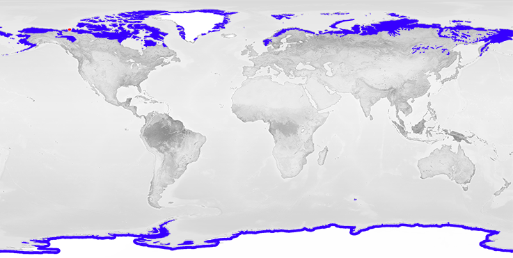
Global distribution of tundra ecosystem (NASA)
different. The large collections of islands known as Canada’s Arctic Archipelago extends much further north than the lands in Eurasia, acting as a larger, if not scattered, triangle of lands extending from Victoria Island in the west, to Baffin Island in the East, and Ellesmere Island in the North. And then of course there is the world’s largest island: Greenland. While rimmed with tundra around its coasts, the vast majority of the island is a frozen ice sheet, rather than the grasslands of the tundra (McKnight et al 2000).