Blog 8 by Plan OH: Zoe Rader, Imani Watson, Morgan Mackey

The streets in between High St and Neil Ave are mostly one-way streets. One street in particular is West Norwich Avenue. This street is a one-way going towards Neil, away from High. It consists of lots of housing that doesn’t have driveways for parking, so street parking is required. Sometimes it’s a pain having to access this street from High St and not being able to go towards High St, but it would be even more difficult having two- way traffic on top of the street parking making it feel congested. Because of the housing and the street parking, there’s not much to do to the change the streets and make them better. There’s ample sidewalk access because of all of the housing, but it’s really only wide enough for two people, which isn’t ideal for wheelchairs. However, widening the sidewalks would either take away street width or lot size for housing. They’re a little broken up and run-down, so some re-paving of the street would be a good change. The only ramps onto the sidewalks are at the ends but putting them in the middle takes away from parking. There’s also not a lot that we can change about the street width for the same reason as the sidewalks. One thing we could do would be to allow access to some of the street parking, but then the people who live there wouldn’t have anywhere to park, so that would most likely just create more problems. There’s not usually a ton of traffic flow through this street making it fairly safe for someone to cross, it’s just smart for pedestrians and drivers to be aware of one another.

High Street is a different story though. There’s lots of traffic going through this street on a daily basis at almost any hour of the day. It’s a 4-lane, 2-way road, however, the two lanes on the end are usually occupied by street parking. There is one crosswalk outside of stoplight crosswalks, which is convenient for pedestrians, but not so much for drivers. There’s nothing to signal whether someone is crossing or not. This could be a good implementation. The sidewalks are in good condition and they’re wide enough for roughly four people, give or take. The streets on the other hand are kind of narrow, especially when small turn lanes (which I find very important and useful) are added in. There’s also some construction going on, which occasionally bleeds out into other lanes, causing even more congestion.


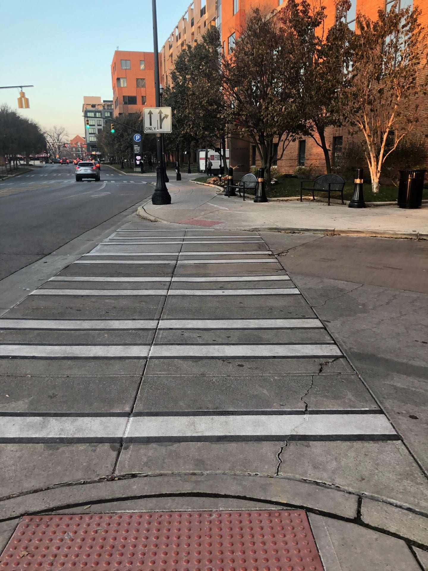
The transportation system on Tuttle Park Place was working very efficiently when our group walked the route on Friday afternoon. The street seems wide enough for daily traffic, with two lanes going in each direction and a turn lane at the stoplights. However, the street tends to get very congested on Saturdays, when thousands of people are in town for the football games. Tuttle Park Place is usually barricaded with security vehicles because the football players stay at the Blackwell hotel. I do not think any size street would be sufficient to hold the amount of traffic that game day brings. On Friday, the traffic seemed to be driving at a reasonable speed, unlike the cars on High Street. The flow of traffic could be slightly improved around the hotel, where visitors pull into a circular drive to access the front door. The drive successfully gets traffic off the road, but if many cars are lined up they could block the crosswalks. The hotel might be better off having a larger entrance in the back of the building, where visitors and their cars would be out of the main traffic of Tuttle Park.

The sidewalks in the area were well maintained and free of hazards. They do not get as much foot traffic as sidewalks further in campus, but the university still does a good job maintaining them. There were ramps at every crosswalk for wheelchairs. However, there were not many benches to sit on throughout the space in case someone needs to take a break or does not feel good. While the path may be meant for moving circulation, students and parents might enjoy having a nice place to sit down in warmer months. As a pedestrian, I felt very safe walking along Tuttle Park. In one section, a row of trees lines both sides of the sidewalk and a wide strip of grass separates pedestrians from vehicular traffic. Closer to Lane Avenue, there is even a building that hangs over the sidewalk and shields pedestrians from the elements. Overall, the stretch of Tuttle Park Place between Knowlton and Lane Avenue is well planned and effectively used.


One of the areas we chose to focus our observations on was the campus area along Woodruff Avenue. In terms of vehicular-traffic flow, it is an area that tends to get quite a bit of traffic. However, the only time traffic flows seem to present much of an issue are either early in the morning when people are arriving to campus, around lunch time when people are coming and going, and later on in the afternoon, usually around 5-6pm when there is an influx of people leaving campus all at once. Woodruff is a two -way street, so there is traffic flowing both ways, which helps to alleviate some of the build-up during times when traffic is heavy. However, from the intersection of Woodruff and Tuttle to the intersection of Woodruff and College Rd, the street does seem to be a bit narrow, with there only being one lane in either direction (excluding turning lanes), whereas when you go past the intersection of Woodruff at Tuttle and College Rd, the street turns into a wider width, two-lane road.

Because the portion of Woodruff we focused on lies directly on the academic campus, just as the area gets a lot of vehicular traffic, it also gets a lot of foot traffic from students and professors travelling to and from their courses as well as others be they workers or visitors travelling throughout campus. It would make sense with that in mind that there be an adequate amount of sidewalk walking space, walkways, crosswalk signs, curb ramps and so on to accommodate for the needs of pedestrians, which is true of the campus area along Woodruff as well as much of the campus area all together. The sidewalks are fairly wide, which is great, especially during times when classes are beginning or letting out. There seems to be curb ramps provided for every walk space. There is an area in front of the North Campus Recreation Center and Traditions dining hall where there are diagonal sidewalks. Being that that area in particular receives a lot of foot traffic the design really alleviates the potential for congestion in the area. You don’t get the feeling that you are walking on top of someone else trying to get to your destination. In terms of street safety, for the most part vehicles travelling throughout the area make sure to abide by the posted speed limit. There is also a crosswalk sign at nearly every crosswalk, or some kind of sign to signal to vehicles that the area is a pedestrian walkway. The one improvement/ addition I would suggest  is that there be a bike lane added to the street just to provide a little more safety to those travelling on bikes.

Extra Credit Blog Post – Plan OH

Zoe Rader

The University District wants to focus more intensely on making High Street denser with various programs (recreation, work, housing, etc.) in order to take pressure off of areas that are hoped to be lower density areas. This in turn allows for the surrounding neighborhoods, and the people that occupy them, to stay in tact without much disruption. By making the area more dense with various programming, they’re hoping to cut down on parking to promote walking, biking, etc. This could be a good implementation or a bad one. For instance, when it’s a beautiful day out, everyone should definitely be encouraged to get outside. However, when the temperatures are below freezing, most are likely to drive, and there should be ample amounts of parking to accommodate these people and conditions.

The low- and medium-intensity areas are reserved for residential structures, mainly single- and two-family homes, and anything more than that won’t be permitted. The lot size allows for an ample amount of living space along with enough room for a yard and parking. The main difference here is that medium-intensity areas are allotted more space to build (0.6 maximum floor area, with low-intensity at 0.4). Higher-intensity areas are also very similar but are allowed 45’ of height whereas low and medium are capped at 35’. Higher-intensity areas are also occasionally permitted to extend the 0.6 maximum floor area to 0.8 or 1.0 depending on what it’s replacing and/or conserving.

Neighborhood mixed use areas are fairly self-explanatory, for example, an apartment on top of a retail store. Areas such as this ad regional mixed use are what they’re looking to continue implementing through High Street. Overall, I think their land use plan is well thought out and will work out well. My main argument would be over the parking because being a commuter, I understand the difficulties in finding a parking spot when I just need to have a 30-minute meeting. I do however agree with having a low intensity residential area compared to the mixed use areas, because families, young children mainly, wont always do well in mixed use areas.


Morgan Mackey

I think the comprehensive plan is smart for the city of Columbus in the long run because it will only benefit the economy if students want to stay in the area after they graduate. However, the plan does not address the residents who are already living around the university, who may have been there for a long time. When our team walked through the neighborhood located along Norwich Avenue, one resident who worked in real estate started telling us how the city recently rezoned the lots to commercial. She seemed very upset because people might be pushed out of their homes, and the tall towers next to them look out of place and could decrease property values. The plan benefits college students by providing more places to live off campus, but it disregards the residents who are already living there.

The last few times our team has walked along Lane Avenue, we found that the height of the buildings are very inconsistent, with the tall Harrison apartment building being placed next to some two-story homes. The variety of styles and sizes causes OSU visitors to just pass through the area, instead of feeling comfortable enough to take a stroll along the sidewalk. The comprehensive plan does not put in place any height restrictions to address these issues, nor does it try to create a more cohesive environment along Lane Avenue. In fact, the plan encourages buildings to be built taller to create a smaller footprint. The plan also does not require existing buildings to expand upward. One way to improve the appearance would be to tear down old buildings and build all new structures, which would cost a lot of money, time, and disrupt traffic along busy Lane Avenue.

The University District Plan could be improved by implementing specific height restrictions and providing more details of campus. At the moment, the streets are a jumbled mess of old houses and new stores and restaurants. The plan only calls for new development to match the height of the surrounding area, but no numbers are provided for maximum height. Height restrictions would create a uniform style along Lane Avenue and High Street, which would look more appealing and create a sense of belonging that visitors would more likely remember. Campus is not clearly represented on the map, which is understandable because it is not subject to the same planning rules. However, even understanding the style and layout of its buildings might influence how buildings look on the other side of High Street and Lane Avenue. One of the main goals of a comprehensive plan is to create an area that makes sense practically and aesthetically, so the university should be included in any new changes.


Imani Watson

A primary feature of the University District Plan that seems to be consistent with prior plans is the focus of centering the concentration of development around the actual university and gradually decreasing the intensity of development further away from the university into more single-family areas. Looking at a zoning map of the University District, the distribution of spaces according to their respective zoning district is fairly vivid and almost tier like. There is the university itself, zoned as “research park”, which expands to commercial area, primarily along High Street and Lane Avenue, which then expands to multifamily residentially zoned areas that then flow into 1-4 family residential areas.

One thing the plan addresses that could very well be just as much a part of the plan in terms of its actual implementation and realization, but also a potential issue as the area continues to develop is density. In terms of yielding the greatest capital development, increasing the density of the area and concentrating the development of the area closer to the university would appear to be a great plan. However, density can also create a considerable amount of problems that would lead one to question whether the capital gain from increasing the density of the area surpasses its cost. The more density an area has the more the area becomes congested, the more the natural environment of the area becomes depleted.

One of the bullet points under the guiding principles of the UDP states: “Highest densities in the form of mixed-use buildings should be focused on High Street between Fifth Avenue and Lane Avenue, and Lane Avenue west of High Street. Higher densities in these areas ensure that future development strengthens neighborhood retail and the walkable, transit supportive nature of the area. Focusing density in these areas also reduces development pressure in areas where lower densities are preferred and recommended” (UDP 41). Walking along High St., you can definitely see the physical translation of the plan, however, though the “walkable, transit nature” of the area is emphasized in the text, the area is so congested and so busy, it arguably undermines that intended nature. Greater density can also complicate the actual application of measuring density. In the text, it mentioned density was measured in terms of dwellings per acre, however, people per acre was proposed as an alternative as the measurement was not fully applicable because a lot of residences in the area though they may have a specified number of living space, for example a four bedroom house, may not have the same number of actual residents. That four-bedroom home, is more likely to house 8 people.

Also, higher density can come at a cost to preserving the historical layout and respecting the historical design and context of a space as well as the physical space/environment itself. Preservation of the historical context of the University District is mentioned several times throughout the plan as well as environmental considerations. However, for instance while we were doing our observations for Blog 5, we came across a realtor in the Tuttle Park Neighborhood who mentioned that the zoning of the area was changed as the university and city became more involved in its development. The realtor said the area had previously been a residential neighborhood, designated AR-4 (Apartment Residential District) and was changed to commercial in a push to make the area more high-density. Design wise, the neighborhood is all over the place and as more buildings and structures go up, the more trees and actual greenery that is depleted within that space.

If a large part of the focus of the plan is increasing density such as to increase development in proximity to the University, I would suggest for every so many structures built there should also be an allotted green space within that area, respective to the size. The realtor we spoke to in the Tuttle Park Neighborhood actually suggested that there should be more tress built with each established development. In addition, more considerations should be taken into account for how to decrease the generated congestion of the area because of its high density nature.

Plan OH’s Blog 2

Plan OH

Path – We chose the Knowlton ramps as our path, specifically the one right in the front doors because not only is it the first path you see when you walk in, it leads up to all floors and takes you directly to room 250.


Edge – We chose this image as our edge because it’s what physically separates the sidewalk from the road; pedestrians from motor vehicles.

District – The Union is a blatant sign that you’re on campus: it separates the city from the campus.


Node – We chose to use the South Oval for our node, because there are multiple points that have multiple paths coming off of each one.

Landmark – since we all are the most familiar with campus, north campus specifically, we chose the clocktower as our landmark. It blatantly lets us know that we’re on north campus and helps us to orient ourselves as well.


Curiosity – As we walked through campus, we stumbled upon this obscure monument, and we realized we always wondered what it was and why it’s placed in that specific location.

 Frustration – We all know it and we all hate it: construction. There’s construction all through Columbus and all through campus, and every time we encounter it, it frustrates us.

Inferiority – The columns, and the building in general, made us feel inferior to the magnificent buildings and structures around us.

Safety – Seeing the blue lights around campus, especially at night, make us feel safe walking through campus.

Serenity – Thompson Library is quiet and calm and gives us a sense of serenity as we walk through it or by it.