JEB Blog #8


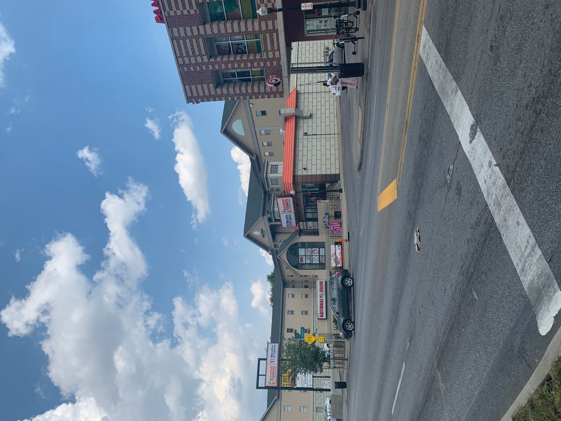
The first location on the path that we stopped and observed was the intersection of W Lane Ave and Neil Ave. Both Lane and Neil are two-way roads, and have similar designs. Lane has two lanes on either side to help move the traffic that comes from High Street and off the freeway along at a steady rate. At the light the road opens up into three lanes with one left turn only lane on both sides of the intersection. A Neil heading towards campus there are two lanes one right lane only turn and a straight or left turn lane. In my opinion the design on Neil could be improved by having a designated left turn lane. This would help with congestion of cars wanting to turn east onto Lane and head to High Street. Overall the traffic flow at this intersection is good and only needs small improvements. An improvement I would make at this intersection would be to the sidewalks and the time they give you to cross the street. Since this crosswalk is the only cross walk on W Lane until you get to High St many students are forced to use it on a daily basis. A problem that occurs is that large groups of students cross the street blocking cars from making either turns onto Lane. A solution to this would be to give cars green lights and not give pedestrians the walk signs at the same time. Adding another crosswalk on W Lane could also fix this problem.

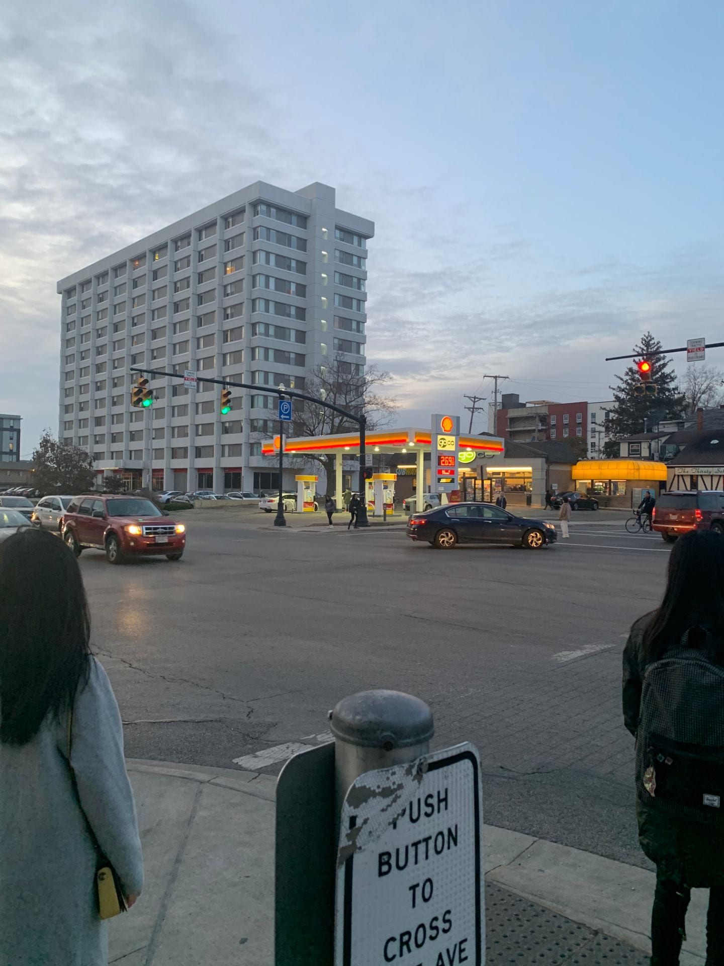
The second area we looked at was the intersection of High and Lane. High Street is by far the most traveled street in the university district. Traffic on High tends to move very slowly due to the amount of lights and pedestrian crosswalks. This can frustrate commuters who only need to travel a short distance but their travel time is doubled because of red lights and pedestrians. While observing the traffic move in and about the intersection we discovered several problems, one being the lane that cars take to turn onto Lane from High. This lane became backed up several times because the cars did not get the arrow symbol from the stop light meaning they were stuck there waiting for an opening in traffic and pedestrians. This makes crossing the street as a pedestrian feel very unsafe since turning cars are rushing to make their turns and sometimes do not look for pedestrians. An idea we had for High Street was to make a bus only lane so cars would not have to continuously switch lanes in order to avoid a stopped COTA. Like the intersection of Neil and Lane the time pedestrians have to cross the streets is very short and wait times are very long meaning pedestrians try to cross the street on their own which causes more unnecessary problems.

The last area we stopped and observed was Woodruff Ave. Woodruff is a two way one lane road running through the heart of north campus. The listed speed limit on Woodruff is 20 MPH which cars tend to follow due to the crosswalks. From the start of Woodruff to Knowlton we counted eight crosswalk some with stoplights and others which allow pedestrians to walk freely across the street at any time. The sidewalks on Woodruff were the safest crosswalks on the path, this was due to the speed of the vehicles and their awareness of the area they were driving through. One sidewalk that caused a large disruption to the traffic flow was the sidewalk next to the Mendoza dorm complex. This sidewalk is not operated by walk sign so many pedestrians walk straight across the road freely. When classes are getting let out groups of students will cross the street until a car slowly inched forward. This can cause a back up on Woodruff that may delay the campus buses. Another observation we made was the amount of bikes, scooter, skateboard, etc that use Woodruff. Woodruff would definitely benefit if it were to have a separate lane for these modes of transportation. The signal timing on the street is perfect for the amount of traffic and pedestrian flow that is seen in this area of campus. Overall Woodruff Ave is very well planned out.

JEB Blog #7

The Drought of 2012

The Drought of 2012 was the worst drought in more than half a century in the United States. It originated with a record shattering heat wave that swept across the US. The drought included most parts of the US, parts of Mexico, and central and Eastern Canada. At it’s all time peak in July 2012, it covered 81% of the mainland of the United States. Overall,  the drought was estimated to cost around $33.3 billion in damages with most of it being to farmers and roughly 123 deaths through the span of the drought. In the article on this by Science Direct, it states that this drought was the worst in terms of moderate to extreme drought coverage since the 1950’s. In the article on this by The Atlantic on August 28, 2012 it displays plenty of pictures of what the drought has caused in the most severe areas. One of the images shows a whole massive field of dead corn that couldn’t get enough water to survive. Another image from the same article shows parts of the Mississippi River uncovered that have not been uncovered since the 1950’s. Finally, there is an image of grass being painted in the state of New Jersey to restore it to its normally green color despite it being brown. This was seen as just a normal drought during the time, but after all the data was collected, it turned out to be one of the worst in US history.

There are many factors that can contribute to the creation of a drought. The most obvious one is simple water waste, In some areas with smaller amounts of water available large amounts of waste by humans can easily cause a drought. Another factor that can create droughts is climate change. Shifts in global temperature can make areas that are naturally prone to climate change even worse, with an increase in temperature comes a spread in desert and dry lands. A third and final effect that can cause climate change is the destruction of ecosystems by humans. Destroying local environments can have disastrous effects on usable water in the area and can ultimately lead to droughts. 

Many parts of the United States have been hit with a drought at one time or another. The Official Website of the Department of Homeland Security offer a few tips in case of a drought. The best way to mitigate the damage of a drought is to be prepared for it. Local governments should issue warnings about water use if they know a drought may be coming. Warning citizens to not wash their cars, not flush their toilets unless they have to and not to take long showers, all of these things will go a long way in conserving water supply. Another useful strategy for preventing and avoiding droughts is by planting plants in your local community that only require a minimal amount of watering, this would prevent excess water being used by green life. A final strategy for preventing droughts is by installing water saving equipment in homes, like swimming pools, washers, and dishwashers. Even fixing leaking pipes could help to prevent water waste. The largest barrier for these strategies is that it can be hard or almost impossible to enforce these strategies, it’s up to the citizens to decide if they want to try and save water to prevent waste.

Blog #6 JEB

Network Restoration II –1326 Indianola Ave. Columbus, OH 43201

Network Restoration II on 1326 Indianola Ave is an affordable housing unit. It is an apartment like complex with 10 housing units. The overall structure of the building looks to be in great condition and safe to house people. The building is made out of bricks which match the building on its side of the road but the complex does not match the homes on the opposite side of the street. The height of the complex stays consistent with the other homes in the area. A problem that we saw was that the building is built in a different direction then all the other homes that share the street with this housing unit. The complex is surrounded by mostly other apartment complexes with the exception of a few small homes across the street. This building is definitely not attractive but it is also not the ugliest affordable housing unit that we have seen. The side of the complex on Indianola is very well kept. No trash is visible on the facility from the street and the grass and bushes are cut and well maintained. The side of the complex on Frances Pl trash can be seen on the street and around the garbage cans but nothing that any apartment complex would have. One problem we found was the parking situation. There are only two parking spots directly on the plot of land. Many of the people living in these units are either forced to park on the street in front of the complex or further down Frances in a larger parking lot. The area around the complex is mostly residential with commercial buildings scattered around the area.

When reviewing the crime history in the area of this affordable housing unit we found that no crimes were committed within 500 feet on the complex. When using the 1000 foot buffer we see two thefts, one vehicle theft and one robbery. When the buffer is increased to .25 miles we see three more thefts and a home burglary. When using the density map within the .5 mile buffer we found that most of the crimes in the area were around N High Street, which is around three blocks from the unit. The area to the east of the complex only has one crime which is a vehicle theft. The area in the immediate area looks to be safe and free of any major criminal activity which many people would think is not the case. When viewing the property values of surrounding area we concluded that there is no significant price increase or decrease the further you went away from the property. This is because the value of the properties in this area are all mostly the same and because the housing unit is in good condition there would be no reason why there would be a change in property value. Near the housing unit there is an Elementary school that is within walking distance. This school received a three out of 10 rating.


CHN University District – 1535 W 3rd Ave. Columbus, OH 43212

1535 W 3rd Ave. is a condo building for the housing around the arena district. It matches the surrounding area in that every building is brick and has the white pillars and window frames. The building also fits the scale of the other buildings in that they have two stories and also two sides to each building. I would consider this building to be attractive in that it is almost uniform to surrounding buildings. The building is well maintained and easy on the eye from the road view. The house could use more flowers and plants to accent the house but overall it is well maintained. The surrounding area is used almost explicitly for residential and more affordable housing but to pair with that, there is a school just down the road. This area is very nice in terms of more affordable housing, and is a good area to raise children with the parks and the school on the surrounding area.

After reviewing the crime history around the complex we found the area seems to be fairly safe. Within 500 feet of the complex there were no crimes reported in the area. 1000 feet from the complex there were only two total crimes committed in this 6 month span. Using a quarter mile buffer we found that still only 6 crimes had occurred in the area. When using the half mile buffer is when crime rates shot up to 61 crimes in the past 6 months. With 30 of them being thefts, 10 burglaries and, 9 vehicle thefts. When turning on the density map we found that crime was prominent north west of the complex between 5th ave and 4th ave. A Lot of these crimes were thefts and vehicle thefts. Another hot spot for crimes was to the south east around W 2nd ave. When looking at the neighboring housing values we found that the values tend to increase the further sound of the unit you go. We believe this is because there is a large park and recreation facility that a block down that would increase property value the closer you are to that. The housing unit is also on a major road that crosses over the Olentangy river. The Hubbard Master School is the closest school to the housing units and it received a 2/10.

JEB Blog #5

The area from the corner of Lane and High to the corner of Lane and W Norwich Ave is home to many chain restaurants such as BWW, Dominos, Chop shop, etc. All of these restaurants are connected by one large building that meshes perfectly with the other buildings that surround it. In terms of structural characteristics, the building has a brick finish to it that is just like the other buildings you see up and down High. The buildings height remains constant with its surroundings and without a doubt the building layout contributes to the area feeling like a community. Since these restaurants share a small stretch of building on High the amount of space each restaurant has can definitely be seen as very close quarters. The proper when walking past it definitely feels very close to road and sidewalk space is very tight. With these restaurants seeing high volumes of people walking in and out in my opinion the building should have been set back further. This would give bikers and people more space to walk on the already crowded sidewalks. One major problem that we discovered when observing this building was its parking. The only parking we saw was right on High street. The complex had no parking lot or area for customers to park. Behind the complex there is a very small parking lot that no customer would know is there if they are traveling on High. One way that this building could help its parking problem would be to advertise the parking in the back of the complex. Overall this area seems to be very well planned out and there are not many issues related to it.


The houses on  W Norwich Ave are very uniform in the way that they have very neutral colors and are also covered in siding. The use of the buildings make sense in that they give students cheaper housing than the dorms while also bridging into independent life. It is appropriate for the area because it is close enough to campus for students while also being off campus. The height, size, and shape of all the buildings in the housing area are all very similar and placed about the same length apart. I feel like the buildings are very close and that they feel like a cohesive community. It also helps that on the weekends all the students are home and tend to hang out in their yards, causing more interactions between neighbors. With how close the houses are together, it seems as if they are too close to one another and that you could hear what is going on in the other house if they are moderately loud. The buildings are open lawns with little to no greenery separating the houses, causing a lack of privacy. The setbacks of the houses are very minimal and do not seem appropriate. The only housing with more setbacks are the ones with the parking in the front, causing the character to be a bit less uniform. This is not always a bad thing, but it becomes one when the only thing different about the buildings are the spots of parking. Some buildings have none, some have some in the front, and the others have it in the back. There is not a sufficient amount of parking for these houses even with the lots that they provide. Just walking through the neighborhood you can see the mass amount of cars parked bumper to bumper on the streets. I would make more space in the back lots for parking so that the streets could remain cleaner and more easy to move and drive on. This housing area is overall very uniform except for the parking in that some have lots while others do not. The best thing would be to move the parking off the streets and into bigger lots behind the houses.

   The stretch of road between Neil and High on lane is filled with mostly residential buildings and churches. Most of them are brick, with a few having tan siding instead. Most of them fit in fairly well with each other, except for the small gas station that sort of sticks out. The setbacks are fairly even and close to the road. Most of the residential and church builds have their own small private parking, but no public parking is available on this stretch except for when using the gas station. Building spacing is tight and very close, with campus dorms taking up most of the campus side of the street, luckily the road is wide so the street doesn’t feel cramped. Also much greenery is placed on the street to make the area feel fresh and vibrant. The traffic is heavy and it can be quite difficult to cross the street during busy hours. Overall the area has some of the nicer apartments on campus and is a good area to live in for students. Being close to high street allows for easy access to restaurants and convenience stores and the walk to campus is extremely easy. The only criticism I would have is the lack of crosswalks on Lane Ave.

JEB Blog #4

Planning Problem #1: Homelessness in San Francisco, California

This article explores the rate of homelessness and the dangers that it brings. The numbers would have jumped 30% in 2017 if they didn’t change the rules for qualification of homelessness. A resident even said that she was spit on by a man that looked beaten and high on something. This is caused by the increase in big businesses moving into the area, causing low income jobs to be getting less and less prominent while also getting harder to find. They are opening more and more homeless shelters but they are unable to keep up with the increase in homelessness. Finally, the increase in housing prices is making none homeless people move out because of the fear of becoming homeless.

Advocacy planning aims to represent groups that are unable to voice their opinions. This tends to be people of lower socioeconomic standings whose opinions get overheard by the upper class. Advocacy planning is a great approach to try to fight a homeless crisis. An advocacy planner in this case would not push for a ban of homeless from the streets instead they would push for increased options for the homeless. These options include more beds at shelters or increased affordable housing. San Francisco’s main problem is with many large wealthy companies moving into the city housing prices have skyrocketed causing many people unable to afford homes. A problem with the advocacy planning approach in this situation is that San Francisco is home to a large upper class population so it will take a lot for the lower socioeconomic classes voice to be heard.

Collaborative planning may be San Francisco’s best option to tackle their homelessness crisis. Collaborative planning is the coming together of all sides in hopes to find a common ground that the group can agree on to make a positive change in their shared society. A collaborative planner can communicate with people of any socioeconomic status. The lower class and homeless will fight for more affordable housing units or shelters for them to stay. These people may also vouch for help from professionals to get them out of poverty and off the streets. The upper class may not want these shelters and housing units around their neighborhood because it may decrease the value of their homes.The planner would now have the tough task of finding a common ground for these two sides. The downfall of the collaborative planning method is that one side may be interested in working together but the other sides may want no part in compromising with that group of people for whatever reason.

References:

https://www.foxnews.com/us/san-francisco-homeless-stats-city-blames-big-business-residents-officials

https://www.mckinsey.com/industries/public-sector/our-insights/homelessness-in-the-san-francisco-bay-area-the-crisis-and-a-path-forward


 #2 Traffic jams in Columbus, Ohio


             This article explores the issues of the traffic in the central Columbus areas and how the highways are getting more and more congested during rush hours. In 2018 alone, Columbus drives on average lost 71 hours of their lives in traffic. It takes Columbus drivers about 4 minutes to travel a mile in the inner city areas during peak hours. There are many solutions to this, but some just aren’t possible. An ODOT administrator says that we have, “built as many lanes as we can”. With this, we have no more space to open lanes without obstructing other roads and ways of travel. One of the positive solutions is to open a “smart lane”, which would be another lane on the shoulder during rush hours that would allow for more traffic flow. So far, all we’ve done is added signs that warn drivers of the traffic speed up ahead, but drivers don’t appreciate the money put into recognizing the traffic problem and not fixing it.


            Radical Planning is the field of planning that focuses on radical solutions to challenging modern day problems. A Radical Planner would look at the problem of traffic in Columbus and create a radical solution to the problem. For example, Elon Musk is a radical planner with his idea of building an underground tunnel system that can reroute traffic, maybe this idea could be implemented in Columbus which would relieve traffic congestion. Radical planners would be unlikely to take advice from other traditional planners and would focus solely on new ideas. The main advantage to radical planning is that unlike other more traditional planning fields, radical planning isn’t afraid to try out new ideas and would risk going against the wishes of a community if they feel it would have a positive effect in the long run.


           Another type of planning would be advocacy planning. An Advocacy Planner would focus on representing an interest group, like the commuters of Columbus, and would collect ideas from them and represent their wishes to the city. An advocacy planner for Columbus would work with commuters to find ways to relieve traffic. This could include Ideas like building more highways, increasing the speed limit or even creating one-ways to redirect traffic more efficiently. I think that the best idea for Columbus would be finding ways to have less people on the Highways. Maybe creating better public transportation would lessen the need for people to drive individually. Many people have petitioned for a better public transit system in Columbus for years and an advocacy planner would work with them to make that happen.


References: https://www.google.com/amp/s/www.dispatch.com/news/20190218/its-not-your-imagination-youre-sitting-in-traffic-longer%3ftemplate=ampart


https://abc6onyourside.com/news/local/bad-central-ohio-roads-are-causing-drivers-more-than-just-headaches

JEB Blog #3

JEB

Evan, Josh and Ben


The location of revitalization on N High Street we chose was from the corner of High Street and E Woodruff Ave. This area currently is home to a Dunkin Donuts and other small companies. Connected to these shops is a very large apartment complex called the Ohio Stater which houses many Ohio State students. While our group was inspecting this location we talked about the many issues that this plot of land had. A problem we discussed was that the complex was massive and was taking up a lot of unnecessary space. Another problem we found was that the area is just not in good shape. The pavement is very cracked and filled with potholes and has not been redone in years. Overall the area is an eye sore and revitalization will benefit not only the apartment complex but the shops that are connected.


The first idea for revitalization we came up with for this plot of land was to create a new and improved apartment and shopping complex like the ones you see further down the High Street. This apartment complex will house hundreds of off campus Ohio State students. This would add more off-campus housing options to OSU students and allow for new business to cash into the economy of the university area. The new building will be right up against High Street removing eliminating the problem with misuse of space. Students will be able to park in the existing parking garage that currently sits behind that complex. 

             Our second idea for the space was a public park. This would be freely accessible to anyone and would help to brighten the busy and bustling high street commercial area. This would also provide a place for all nearby residents of the apartment complex a place to rest and relax without having to make the long walk to the oval. Overall this could also have a positive effect on land value in the area and wouldn’t be that expensive to maintain. With OSU’s tradition of making large green spaces, it shouldn’t be hard to find investors to back the construction of such a park.

              It can probably be guessed that the space we selected, so close to campus, has an extremely high land value. We would need large investments to buy and then transform the lot. This would most likely be achieved by first asking the University for some sort of aid. Since our plan would be a public work and would benefit the campus. Secondly we could ask the city for grant money for the park, some sort of subsidy might exist for public recreation. Finally we would have to ask private investors like local apartment buildings, and see if they’d assist with the cost of construction. Since both of our plans benefit local businesses on high street they might be willing to sponsor us.

JEB Blog 2


Path–  This photo shows a path. The path that is being pictured is  N High Street. N High Street is one of if not the most important and popular path around campus.


Edges – This photo of the corner of N High Street and Lane represents the edge of north campus and all of the new dorms. If you continue north you will leave the university district and enter Clintonville and Old North Columbus. 


Districts – This photo of the Ohio State sign down by the student union represents a district. The university district in Columbus takes up a large part of northern Columbus and it is very easy to recognize once you have entered the university district.


Node – This photo represents a node. The Ohio State Student Union is one of if not the most recognizable buildings on the Ohio State campus. It is home to three dining options and many other important organization. Many students use the union to orient themselves on Ohio State’s large campus. 


Landmark – This photo of the Newport Music Hall on High Street represents a landmark. The Newport is the best place to go for great entertainment night in and night out. The Newport is also very recognizable and hard to miss while walking down High Street.


Fear – This photo of a crosswalk near Donatos Pizza illustrates the emotion of fear. This crosswalk is one of the most unsafe crosswalks on High Street. There is no stop light at the crosswalk so many times cars are unaware of the need to stop for pedestrians.


Anger – This photo shows the emotion of anger. The Barnes and Noble is not only a long walk from campus but when you get there you tend to spend a lot of money on textbooks and other school supplies. 


Excitement – This photo of the Gateway movie theater brings many people excitement knowing that soon they will be on the edge of their seat watching their favorite film series and actors. All while enjoying a nice bag of popcorn.


Happiness – This photo of Buckeye Donuts illustrates the emotion of happiness. Whether you stop there in the morning and pick yourself up a fresh donut or get mozzarella sticks after a late night out Buckeye Donuts will not let you down.


Annoyed – This picture of traffic lights and traffic cones on High Street shows annoyance. I cannot remember a time when High Street has not been under construction. The construction closes side walks and makes it a chore to drive down High Street.