Blog 8 Sim City

Around the campus area, the traffic flow is light due to how many pedestrians are walking. Drivers tend to avoid areas like Woodruff Avenue and Neil Avenue because of the crossing students. All the roads were two way roads with the exception of Norwich Avenue which was a one way. The speed of traffic is twenty miles per hour on campus roads like Neil and Woodruff. High Street ranges from twenty-five miles per hour to thirty miles per hour. Lane Avenue’s speed limit is thirty-five miles per hour. These speed limits stay relatively low due to the amount of pedestrians that cross these roads. It does not seem that many drivers follow these speed limits. This could be due to how little the speed limit is displayed on the road or how little it is enforced. Columbus could put speedometers on roads like High Street and Lane Avenue to ensure the safety of the people walking.

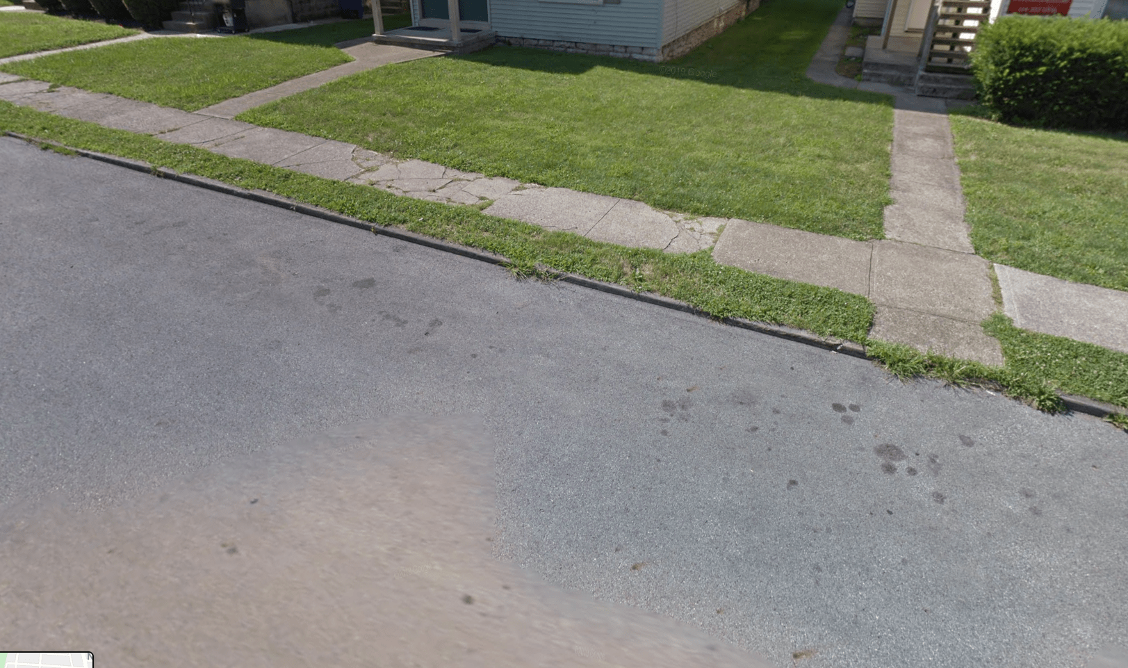
The sidewalks within the surrounding neighborhoods look old and dirty. Their colors are brown and grey. The sidewalks are quite narrow and irregular, with many cracks and dirt on them, making it unsafe for children, elderly people and disability people to walk on it. Plus, trees in different sizes are also randomly planted in the middle of or somewhere on the sidewalks; the sidewalks are filled with blocks-which are in different sizes, making the sidewalks look not uniform and out of management. It also causes the difference of sizes of private gardens along the sidewalk; and during fall time, leaves fall on the sidewalks and then decay, making the sidewalk look unclean and gloomy. Comparatively bad sidewalks can also be a “minus” on property values in the neighborhood.  

The streets with a higher volume of cars like High Street and Lane Avenue have four lanes to accommodate the traffic. Smaller roads like Norwich have only one lane that could be made wider. The road is tight to drive down due to the cars parked on both sides of the street. This could make a driver nervous and make them drive slower down the road. A wider road on Norwich would improve the neighborhood. The roads within campus like Woodruff and Neil remain two lane roads which keep the campus quiet. The campus would seem too busy with four lane roads cutting through them. 

The streets in the surrounding area are varied when it comes to safety. The closer you are to OSU campus, the more kept, clean, and easily accessible the streets become. However, in the neighborhoods, the roads are very hit and miss. On Neil Avenue, many crosswalks have no lines on the road indicating the presence of a crosswalk. There appeared to be some construction in the area, making some curbside crosswalk slopes inaccessible. While there are multiple street crossing areas, their safety is questionable. Crossing the street in a residential area tends to be safer than cross roads in busy areas of the city, there could be improvements to ensure that drivers are aware of pedestrians. Thankfully, the street crossing areas closer to campus are appropriately marked and in good condition. The timing for the signal was good, giving us enough time to leisurely cross. The only road crossing signals we encountered were in the areas closest to the campus. I believe highly visible crosswalk painting needs to occur in the residential section. The upkeep on the curbs is paramount for those differently abled, and can present many hazards for those attempting to cross the road.

In general, the curbside ramps present to use for crossing roads are available close and further away from the campus. As previously stated in the Street Safety section above, we witnessed some construction which left some ramps hard to access, especially for people with certain disabilities. Thankfully every street crossing we encountered had curb ramps, so that was a pleasant surprise. Upkeep of the ramps is the major thing needed to happen to keep up inclusiveness. The connection between the curb and the road has a minimal ledge which should be easily navigated by those in wheeled devices or by foot, but the transition from the street to the ramp/sidewalk could be a little more even on some corners.

Blog 7: Team Sim City

Overview: 

Hurricane Andrew was a category five Atlantic storm that hit the Bahamas, Florida, and Louisiana. The storm decimated much of Southern Florida and reconfigured the area.Most of the damage was caused by the strong winds that ripped off roofs and toppled cars. Hurricane Andrew destroyed over 25,000 homes which left 160,000 people homeless. Over a million people were evacuated from southern Florida overnight once the storm was deemed dangerous. The hurricane was hard to track due to these strong winds destroying the wind measuring devices. The wind would blow an object one mile from its original location. Hurricane Andrew became the second costliest storm in America.

Communication:

 At first,only 15 deaths were reported and the number kept increasing as more victims were found.Most of these victims were elderly people, children, and people who had illnesses such as heart disease. Several days after, more people were reported missing by their families and people struggled to get food and power. Thus, the first 6000 troops and 1000 Marines were sent with blanket and water. Later reports showed that 65000 jobs were estimated to temporarily lost and the local economy lost 2.9 billion dollars in order to cover the services. More than 10 percentage of the residents in the affected area were forced to relocate, which also caused a housing shortage and high renting prices problems. It took more than two year for some of the residents to reform their houses; while others chose to never return to the area-causing the Dade County to lost 27 percent of its population. In addition, the storm caused 10 billion dollars in insured damages, which led to the bankruptcy of nine small insurance companies. Final report showed that the storm caused 61 deaths and an estimated 27 billion dollars in damage. This made Hurricane Andrew the second costliest hurricane on record. 

Vulnerability: 

The main aspect of Hurricane Andrew that contributed to the massive destruction was the high speed winds produced by the storm. The wind speed averaged over 150 miles per hour. The sheer wind speed could knock over trees, people, and even entire homes. The amount of debris being propelled through the air via the hurricane cause significant damage, injury, and death. The prevalence of mobile homes increased the amount of debris due to the ease of mobile home destruction via the strong winds; poorly constructed homes also contributed to the sheer amount of devastation and debris. The hurricane also sprouted off a few tornadoes, which increased the amount of destruction. While the areas most affected by Hurricane Andrew established a state of emergency and mandatory evacuations, the lacking ability of storm tracking technology led to most people only having about a day to pack and evacuate their homes. This led to a great deal of people fleeing to shelters or finding makeshift shelter; there were also a portion of people that refused to flee their homes. Therefore, a lot of people found themselves in the heart of the hurricane under trucks, inside sheds, and huddling in their homes.


Future Improvements:

Communities affected by hurricanes, like those affected by Hurricane Andrew, can use new strategies to prepare themselves for these kinds of storms. They can start by building sturdier, wind resistant housing. This can help prevent the damage caused by strong winds. This can be done by using stronger materials to support the building. The roof can be made through careful roof sheathing and framing to sustain heavy winds. The walls can then be supported through concrete reinforcements to hold them in place. This can prevent many from going homeless due to the stability of their home.

Communities can also use technology to their advantage to help prepare for storms. If storms are better predicted than people can prepare for them properly. Instead of using ground based wind measuring tools, the tools could be planted closer to the storm to get a more accurate measurement. This would give meteorologists a better idea of how strong the storm is before it hits the U.S. People would have more time than just one day to prepare their home for a category five storm.

Communities in hurricane zones could also stress better building codes for their residents. This would ensure that people are out of flood zones or too close to the ocean. These codes would also require people to build their homes up to code at the risk of being fined. If everyone’s home is fully adapt for hurricane conditions, a community would not suffer as much damage. 

Implementation: 

Money would be a potential barrier for some of these issues. If the government is requiring people to update their homes to code, it will require money on their part. Some people many not have the means to build their homes to withstand a hurricane. The government could provide a program for these people to help them pay for improvement. Whether it is a loan or a grant, the government can help ensure people’s safety by investing money in precautions before a storm. 

Technology could also be a potential issue in predicting hurricanes. If the hurricane is too strong, the technology could be damaged by being too close to the storm. However, luckily, advancements in technology have allowed scientists to develop new techniques to predict storms. They use land, sea, and air based trackers to help manage the storms. These improvements can predict storms up to 72 hours in advance of when they are supposed to hit land.


Bibliography

“Hurricane Andrew.” Wikipedia, Wikimedia Foundation, 29 Oct 2019, https://en.wikipedia.org/wiki/Hurricane_Andrew#Impact.

“List of Hurricane Andrew’s Victims, How They Died With PM-Hurricane Aftermath, Bjt.” AP NEWS, Associated Press, 4 Sept. 1992, https://apnews.com/98bf59ecce8dd183a44bfac25ea35aaa.

“The 25th Anniversary of Hurricane Andrew.” Atlantic Oceanographic and Meteorological Laboratory, www.aoml.noaa.gov/keynotes/keynotes_0817_andrew25.html.

Victor, Daniel. “Hurricane Andrew: How The Times Reported the Destruction of 1992.” The New York Times, The New York Times, 6 Sept. 2017, www.nytimes.com/2017/09/06/us/hurricane-andrew-florida.html.

Blog 6: Team Sim City

Site 1:Network restoration II

Google Maps, Google, www.google.com/maps/place/1326+Indianola+Ave,+Columbus,+OH+43201/@39.9899775,-83.0032624,3a,75y,172.95h,80.82t/data=!3m6!1e1!3m4!1sHM3Cy7mCMgv-dyWgYDnyyg!2e0!7i13312!8i6656!4m5!3m4!1s0x88388ecf46779215:0x3857899af1fbb34!8m2!3d39.9897842!4d-83.00311.

Evaluation:

Buildings in the surrounding area at this location are all different. The buildings from Network Restoration II are mainly red-brick townhouses; while the townhouses at the other side of the street are yellow-ish and grey-ish color. All three townhouses are all built in different materials and directions. For example, some of them have a private stair and front yard while others only have a shared hallway; also, some of them are facing the street while others facing the buildings next to them. Different from the other townhouses where you can have part of the building by yourselves, one of them is more like a two-floor apartment where you may only have a room of it. There are also single-family houses mixed in the neighborhood, building in different styles, materials, and colors. These buildings are also at different height, with various amount of residents living in. This building can’t be an attractive one because the neighborhood is dirty, old, and complex. It’s also lack of facilities such as a parking lot and the area for people to do exercise. There are some grasses and trees but there can be more; there are also trash on the ground that could be taken care of by the community because I can hardly see any dumpsters; in addition, several lights and electricity lines make the neighborhood look disordered; and lastly, there is only fencing around the single-family houses since most of these spaces are shared by multiple people and there is no certain people who is responsible for the fencing. The building we are looking at is almost at the center of a big neighborhood, so most of the buildings in the surrounding area are residential used. There is a Kroger and a pharmacy right outside this large neighborhood, which is within walking distance and very convenient for residents to get things they need. There are also many other stores and restaurants on the main street that outside the neighborhood. In general, the conditions and environment in the neighborhood is not very satisfying, but it is easy to approach the nearby business areas. 


Secondary Effects:

When observing crime analytics at 500 ft of the Network Restoration II, 16 crimes occurred in that area; at 1000 ft, 96 crimes occurred; at .25 miles, 197 crimes occurred; at .5 miles, the number of crimes was so high that it would take an immense amount of time to count. Taking into consideration the amount of crimes at .25 miles, 197, I would estimate that the number of crimes occurring at .5 miles would be well over 300. Using the density map, the most dense sections of crime are not concentrated on the property, but close by. If observing the density at different levels, the crime density does change, however, it is never located at the Network Restoration II. Although it is observed to be fairly consistent around Weinland Park and along High Street. While the crime map can be a bit convoluted, it appears that burglary from motor vehicles and assault are the most common crimes at .5 miles from the Network Restoration II. The property values of the areas within 500 ft of Network Restoration are around 250,000. When 1000 ft away, they decrease towards Krogers to 200,000 and increase away from Krogers to about 300,000. When 0.25 miles away, there seems to be no significant jump in prices of the surrounding homes. The housing is staying in relatively the same price due to similar value of the land. All the surrounding housing is similar quality to the Network Restoration II so it would make sense to have similar pricing. The school district in the area is Columbus City School District. There is an elementary school within a mile of the housing that has a three out of ten on GreatScore. 


Site 2: Commons at Third

“Commons At Third.” Google Maps, 2019,

www.google.com/maps/@39.9854484,-83.0320364,3a,75y,70.56h,90t/data=!3m7!1e1!3m5!1sE3vpG7Rza2HZdIPR9aI-6g!2e0!6s%2F%2Fgeo3.ggpht.com%2Fcbk%3Fpanoid%3DE3vpG7Rza2HZdIPR9aI-6g%26output%3Dthumbnail%26cb_client%3Dmaps_sv.tactile.gps%26thumb%3D2%26w%3D203%26h%3D100%26yaw%3D65.264366%26pitch%3D0%26thumbfov%3D100!7i16384!8i8192.

Evaluation:

This property matches the surrounding buildings in its architectural style and building materials. The look of the affordable housing matches surrounding buildings like the Quinn and the Edgehill.  The Commons at Third also match the size and shape of the surrounding buildings as they are also multiple-family homes. The Commons is architecturally beautiful in the mix of glass, stone and brick. The area looks well kept and cared for for the residents.Parking is used on the street as well as behind the building. The only improvements that could be made is the excessive construction that is occurring around the area. However, this does not take away from the beauty of the building. The looks of the housing facility exceed the surrounding areas even though they are fairly similar. Around the Commons at Third there are many businesses for the residents to use. While the building is surrounded by some residential buildings, most of the area around it is commercial. These commercial areas include businesses like Goodwill, Hot Yoga Studio Columbus, Budget Car Rental, and Market District Supermarket. These stores are in a good location for the residents especially the grocery store. The Market District Supermarket is only a block away from the Commons at Third. 


Secondary Effects

When observing crime analytics at 500 ft of the Commons at Third, 10 crimes occurred in that area; at 1000 ft, 19 crimes occurred; at .25 miles, 44 crimes occurred; at .5 miles, 144 crimes occurred. Using the density map, the most dense sections of crime are not concentrated on the property, but close by. If observing the density at different levels, the crime density does change, however, it is never located at the Commons at Third. While the crime map can be a bit convoluted, it appears that burglary from motor vehicles is the most common crime at .5 miles from the Commons at Third. The property values of the area within 500 ft of Network Restoration II are around $300,000; the property values within 1000 ft are around $350,000; the property values within .25 miles are around $400,000. However, the range of housing prices in this area vary wildly. The price would dip down to around $190,000 and rise to $544,00; these prices were true from the 500 ft area to the .25 mile area. It does seem that the property values of homes appeared to increase the further away from the affordable housing. These housing facilities are not within any school districts. The closest school is a private school that parents would have to pay for. 

Blog 5 team Sim City

Building Use

A majority of the area’s building use flows well since it is mostly residential. However, there are a few points where commercial meets residential is a not so cohesive way.

A bar directly next to housing

The location of a gas station next to housing seems alright at best. However, a bar so incredibly close to the house beside it seems out of place. The loudness of patrons and basic bar settings would disturb the peace of the housing next door.

Church and parking lot directly next to housing

As for the church, having the location be next to housing isn’t completely out of the question; however, having the parking lot in front and directly next to the house seems odd. I would believe that whenever church services would be in action, the noise of the card in the parking lot would also be a disturbance to the nearby residence.

Vacant business, barbershop, and waterbed supply store directly next to housing

The mixed use businesses really don’t seem to belong sandwiched between two separate apartment buildings. While the barbershop potentially belongs in a residential area due to the services rendered, the waterbed supply store seems I’ll placed. The vacancy of the one on the far left also adds a less than stellar feeling to this block


Structural Characteristics

While there are some areas in this residential sector that are very cohesive, the majority of buildings tend to be a hodgepodge of height, size, and design. These discrepancies lead to small sections of the neighborhood feeling connected, but overall it is not a cohesive community.

Four buildings that have no cohesiveness whatsoever

These apartment buildings seemingly have separate styles and color schemes. While the first and third building appear relatively similar, they do not flow well into the other buildings and are a bit jarring. Also, the first three buildings all seemingly have two stories while the fourth building has three. These differences make this section very disjointed.

Housing with various sizing

Continuing down the street, the housing in this area varies wildly, especially considering the multi floor difference and overall housing use. We observe here multi-level, multi-family housing with a single family home in the middle. The heights of the building are not cohesive whatsoever, neither is the shape or style of the housing. This section of the street feels even less like a community than the previous section.

Varying sizes in businesses

Additional varying sizes of businesses

Business building height is pretty stark between the CVS and Wilson Place, and even more so with the businesses further down the road. While the business use in the area makes sense, the overall height, style, and shape of the buildings is just as jarring as the residential area we had just walked from.

Building Spacing

We found many building spacing issues as we walked through the surrounding neighborhood. Most of them are about whether the spacing is appropriately and how these spaces are used.

Extremely narrow spacing between houses


As the picture above shows, an alley between the two houses is only enough for one person to walk through, which makes the two buildings very close to each other. The tiny alleys make the neighborhood overcrowded and lack of privacy; it also prevents the house from more sunlight. We observed most of these tiny alleys and they all look gloomy and dirty. There are rarely plants along the alley.

There are also spaces between the building that are not reasonably planned and used. Besides the crowded spacing, there are many others spaces of different sizes, which make the neighborhood not look uniformed. Some building spaces near the commercial area are poorly used. For example, we can clearly see the stairs, pipes and half of the other building through that space-as shown in the picture below. This makes the area disordered.

Awkward alley space between housing and a business

Setbacks

Most houses in the surrounding neighborhood has a fair amount of setback from the streets. There is enough room for a set of stairs and a front yard with grass. There is a shared stair firat and two private stairs that lead to each house. Residents may feel more privacy and have more fun with these setbacks.

Housing with moderate setback

Next door is housing with a low amount of setback

However, this housing, separated from the housing next door with decent setback, has a much smaller setback-no shared stairs and almost no front yard. Different setbacks of these two buildings avoid all the houses on this street standing on one line, which have a negative impact on the outlook of the neighborhood. We also think that these may lead to the inefficient use of the space.

Parking

Small parking lot between/behind houses


The houses that are located on Norwich Ave have very sparse parking. Most houses have a driveway that gives the homeowner a place to leave their car. Instead of a driveway, the house on Norwich have an area to park behind the house which looks like a cluster of spaces. Some houses like the one shown above have a small area next to the house where the homeowner can park their car instead of leaving it behind the house. This seems functional in that it gives the homeowner access to parking, but it seems that it could be better executed. If there was a driveway attached to these houses, the land behind the homes could be used for building or as space for a backyard.

Narrow two lane roads with both side street parking


Another issue with the parking on Norwich is the allowance for cars to be parked on both sides of the road that is two-way. This is dangerous and makes it hard for two cars to pass one another on the road. This could be avoided by the cars only being allowed to park on one side of the street. This would allow for cars to pass safely down the road.

Blog 4

Problem 1: Gentrification in D.C.

Gentrification is a large issue when it comes to urban planning. As cities improve, the cost of living goes up. This causes the displacement of many people that can not afford their homes anymore. In Washington D.C, the United States capital, the gentrification rate is the highest in the country. The gentrification of neighborhoods surrounding the capital has caused 20,000 African-Americans to be without a home. Over 40 percent of the neighborhoods experienced heavy displacement in a twenty year period.

The advocate style of planning would be best to speak for the people who are being displaced. A planner can use their place in the government to speak for the people who cannot. For example, the planner can stress revitalization versus gentrification. Revitalization would fix the neighborhood for the existing residents while also improving the quality of their life. This approach would not raise the cost of living as much as gentrification would. An advocate planner would look out for the people who are living in the areas that are being improved as opposed to looking at what’s the best was to improve the area. The disadvantages of this approach would be that the advocate planner may not have that much power to cause change. There could be people that are looking at the advantages of raising the cost of living in the city.

The consensus style of planning would also work to change the issue of gentrification. The consensus planner can use information from not only the people who would get displaced, but also from the town to make changes to the city. In this way, the planner could make as many people happy as possible. For example, they could improve cosmetic issues in the town, but not add major stores or eateries to attract new people. This would improve the quality of the town for both the city and the people, without increasing the cost and displacing so many people. The disadvantages of this approach is the planner not being able to get all the information they need to make decisions. The people of the town could not respond to their surveys and the town could not want to listen to the needs of its people.


Problem 2: Traffic Congestion in New York City

Traffic Congestion is not only a major hindrance on the everyday commute in larger cities, but can result in structural damage and loss of life. Wasting time on the road during a commute can be a huge inconvenience to people who drive into the city from New Jersey and New York state. According to Curbed, New York is the third most congested city in the world and the second worst in the United States in terms of traffic. New York drivers spend 13 percent of their time, which is about 118 hours per year, sitting in congestion on the 4.7 mile stretch.  This traffic is a major issue in New York City which causes many people to skip the drive and walk instead.

Using the neutral public servant planning style, change and action would be better implemented due to the lack of community interference. While a neutral public servant planner wouldn’t necessarily tell the community what it needs to do, using their knowledge of the city plan and transportation system, they could create an effective plan that would benefit all. Having too many opinions in play when it comes to the traffic congestion would potentially muddy the situation. Politicians and city officials might prefer street alignment that benefits economic flow rather than commute ease for the everyman. This approach would give a solution that would be best for everyone instead of favor one party over another. A neutral public servant planner would recommend widening streets to accommodate bike lanes or possibly implement policy that would allow turning on red lights instead of only green (where applicable). This style of planning would approach the issue in the generally helpful manner, suggesting ideas that are useful for the everyday and really solve the heart of the issue.

One could also use the entrepreneurial approach to planning the traffic in New York City. This planner could manage block grants to improve the streets. For example, they could use the money to widen the streets to get rid of the consistent one-way streets around New York City. The entrepreneurial planner can use their skills and market a new approach to streets to the city government officials. This planner would be efficient at getting their ideas across as well as negotiating with the officials. As New York City is one of the most powerful cities in the world, it would take a lot of convincing for the planners to do this. These issues would interest the entrepreneurial planners due to the effect this project would have on the economic development of the city. With better traffic, more people would enjoy going to the city and would not be afraid to hit the traffic. The cons of this approach would be that they would not be as connected to the people of the city as other planning approaches would be. An entrepreneurial planner is more invested in the business side of planning as opposed to the people side and would potentially miss key details of planning for the people.


References


Baca, Alex, and Nick Finio. “Gentrification Is Beneficial on Average, Studies Say. That Doesn’t Mean It’s Not Painful for Some.” Greater Greater Washington, 6 Aug. 2019, https://ggwash.org/view/73267/on-average-gentrification-helps-people-but-that-doesnt-mean-its-not-painful-for-some.

Cohen, Shawn, et al. “The Real Reason for New York City’s Traffic Nightmare.” New York Post, New York Post, 3 Dec. 2016, nypost.com/2016/12/02/new-york-citys-traffic-is-intentionally-horrible/.

Paz, Christian. “DC Experiencing High ‘Intensity’ Gentrification, Study Says.” NBC4 Washington, NBC4 Washington, 21 Mar. 2019, https://www.nbcwashington.com/news/local/The-District-Has-Experienced-the-Most-Intense-Gentrification-in-the-Country-Study-Says-507431441.html.


Walker, Ameena. “New York Drivers Spent an Average of 91 Hours in Traffic Last Year.” Curbed NY, Curbed NY, 6 Feb. 2018, ny.curbed.com/2018/2/6/16979696/new-york-city-traffic-congestion-second-worst.


Sim City’s Blog 3

Photos of Existing Site:

Problems with the Site:

The first problem with the site is the eye-sore of a parking lot. The parking lot is the first thing you see when passing this area on the street and is not pleasing to look at. The look of this also makes people not want to live in the Ohio State Student Housing that is housed just behind this parking lot. On top of the unpleasing look, it is also hard to get in and out of due to the incline. The parking lot is raised so it makes using it potentially dangerous. The shape of this building leaves much to be desired as well. The building is a horseshoe shape that is unsymmetrical. The stores on one end stretch out in weird directions and some are placed under the parking lot. Due to the stores being underground, there is a small area where one can walk down the stairs. There are often people who smoke in this area and linger. This makes the customers at these stores and restaurants uncomfortable and weary of shopping there. These stores also have signs that do not match with one another. Although all the buildings are in the same parking lot, the signs seem wonky and ugly. Another unpleasing aspect of this site is the color. The surrounding buildings are a red brick that match the University dormitories across the street. However, this building is a yellow taupe that washes out the building. On top of all this, the sidewalks and streets are in desperate need of repair. They have cracks and potholes that could be dangerous for pedestrians and automobiles.


Recommendations for the site:

1st potential option: A messy parking lot in front of the building badly and negatively affects the outlook of the area. In order to solve this, we suggest that the parking lot can be placed underground, such as a B1 Floor. This can not only save the space in front of the building and use the underground space more efficiently, but also provide more opportunities to add additional facilities around the building. For example, if we push the building half-way forward, then a fountain or a more beautiful entrance can be built, which may attract more people to move into the apartment and further contribute economically aspect as well. At the same time, the backyard of the building can be built as a garden or a Gym for people who live there to relax and hangout. 


Sketch:

2nd potential option: The building could be demolished and then rebuilt closer to the street. The outside of the building would mimic the red brick of the surrounding buildings on campus and off. That way the area would look more cohesive and aesthetically pleasing. The top couple floors of the building can be used for the student housing that previously existed. The ground floor can offer commercial businesses like Dunkin’ and Joy’s Village Chinese Food. The parking can then be moved to the back of the building where part of the previous building existed.


Sketch:


Implementation and Feasibility:

1st potential option

Implementation: Provide off site temporary parking for the students that reside in the student housing. This leaves the parking lot open for upheaval and placement of underground parking structure. The underground parking would include an access doorway to the sunken shopping area on the corner of the lot. Once the parking structure is complete, providing temporary off site housing for the students while a demolition and rebuild of the main housing building is underway. The building will be moved farther forward on the lot, leaving enough room for a courtyard with benches and greenery for extra space for congregation. Once the housing is rebuilt, utilize the empty space behind the housing for a garden/grilling area or perhaps an indoor gym.


Feasibility: Finding off site parking and housing will be the greatest hurdle for this project. Parking is a bit easier, although it will create strain with the relationship between building project management and the students. Finding temporary housing for the students will be the biggest detriment to this project. Perhaps the renovations of the housing can be done in stages, so only sections of the Ohio Stater will be under construction. If there are enough empty units, there is the possibility of shifting students to other rooms and wings of the Ohio Stater in order to facilitate construction. The monetary funds needed to undergo this project could mostly come from the parent company that manages Ohio Stater to improve student experience and increase profitability of the site. Grants from OSU and maybe the city of Columbus are also possible in order to maintain quality housing for off-campus students.


2nd potential option

Implementation: The demolition of the sunken shopping area would be the first action needed. After the front area of the lot is leveled out, the main Ohio Stater building would need to be at least semi demolished and moved further forward on the lot. The first floor of the building would become the businesses that were originally on the sunken corner, making a pseudo shopping mall at the ground floor of the housing complex. An addition of one to two floors on top of the building to accommodate for the space taken by the businesses, and the attraction of more students wanting housing, would give more than enough room for growth. The area where the housing originally stood could be repurposed as the main parking lot. With parking in one whole area, tighter security and fencing can be implemented for peace of mind.


Feasibility: Shutting down the businesses would be the bigger issue with this option. The revenue lost due to the construction would put these businesses in the negative. It is possible that off-site temporary pop-up shops could be used, especially in considering the restaurants. Again, as with the first potential option, finding off-site housing during reconstruction for the Ohio Stater would present some issues. Off-site parking, while an issue, can be solved far easier. The rehousing of the students would be necessary in both options listed; another possibility stated above would be cyclical reconstruction and having students migrate to other open units.