Site-Researched: 1535 West 3rd Avenue, Columbus, Ohio 43212
Site Characteristics
The property we visited is known as the “CHN University District” affordable housing complex, which is owned by CHN University District LLC, a company that acquires and rehabilitates housing units. It is funded privately (LLC), with funding being directed by the Fifth By Northwest Commission. This neighborhood organization acts as a intermediary between the Northern Grandview Heights community and various groups, such as residents, developers, property owners, and elected officials. The single-building site, built in 1926, houses two multi-family units and thus serves low-income families residing in the area. The land-use classification of the property is 680, meaning that any charitable structure can be built on the premises as long as it is not a hospital. The square-footage of the building itself is 2,880 square feet, while the total assessed value of the property is $315,000.
Building Aesthetics
Upon visiting the site, one is pleasantly-surprised to find that the affordable housing property fits in with the surrounding architecture. This is due to the fact that all of the buildings in the surrounding area were constructed in 1920’s, meaning that they all follow a similar architectural design. The low-density apartment building is surrounded by others just like it, creating a street view which pleases the eye. The facade of the structure, complete with greek-style pillars and brick finishing, creates a simple yet attractive look (Picture #1).

Picture #1
Building Maintenance
The property is incredibly well-maintained, especially compared to some of the apartments around it. Landscaping work (including mulching) has been done to the front yard, creating a clean/crisp look. (Picture #1) The property features several trees which provide a nice amount of shade for the surrounding area. The front yard also includes a dual-level porch complete with door lighting, providing residents with a safe environment at night. Walking to the back of the building, one quickly notices the organization of the air-conditioning units and electrical box due to its symmetrical nature which is pleasing to the eye. (Picture #2) Because the apartment is comprised of only 6 units, the parking lot is made of gravel (suitable for low-density buildings). The gravel is freshly laid in an organized manner away from the back alley that connects the parking lot to 3rdAvenue, which runs past the front of the building. (Picture #3) Trash cans are kept behind the property and contain all of the residents’ waste; as no loose garbage can be found on the premises. (Picture #4) Surveying the perimeter of the building, one cannot find a single example of deterioration, whether it be from graffiti, wear-down of structural components, or chipping paint. Such observations make it clear that the property is incredibly well-maintained and that the residents likely take pride in the building in which they live.
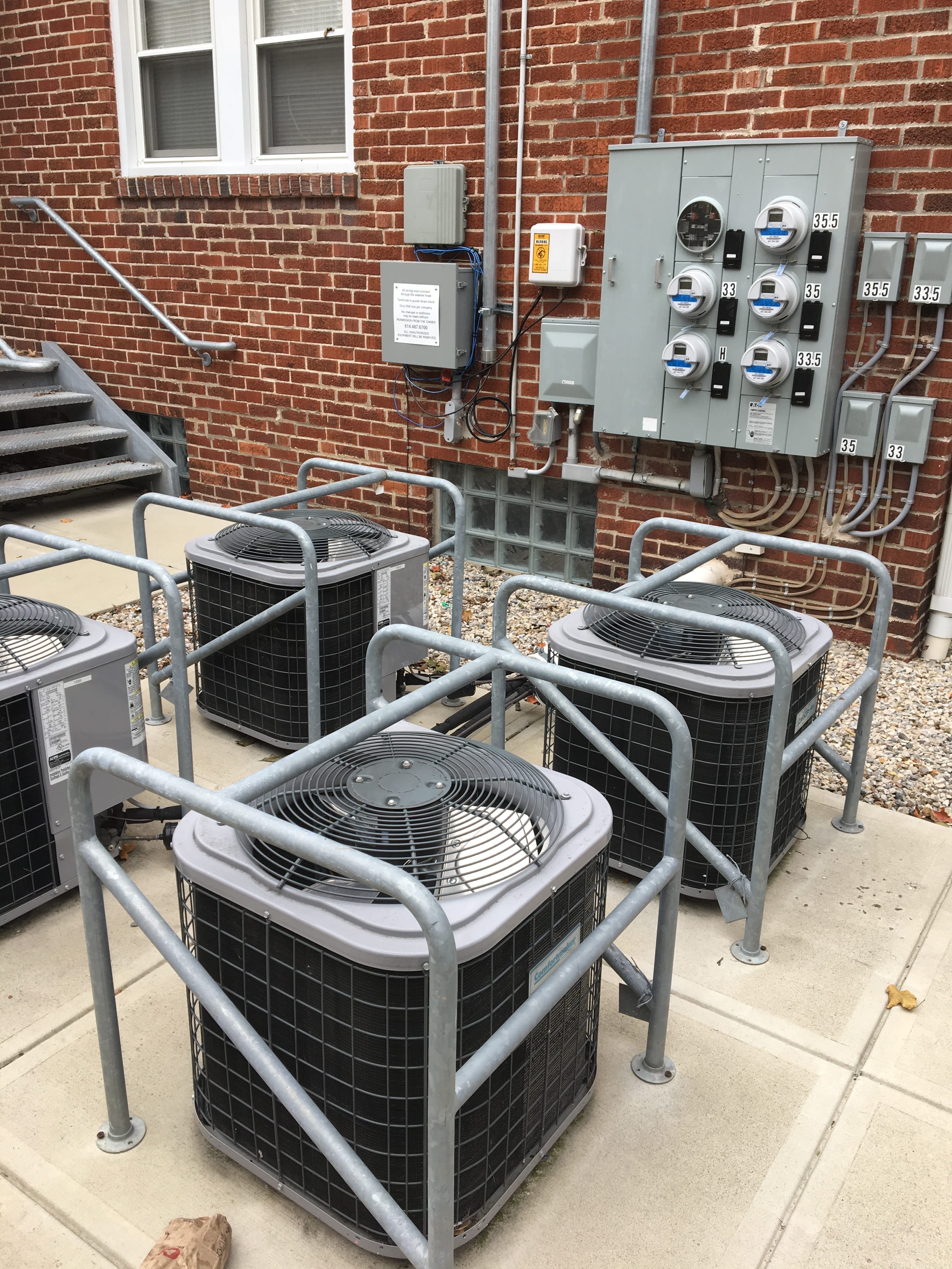
Picture #2
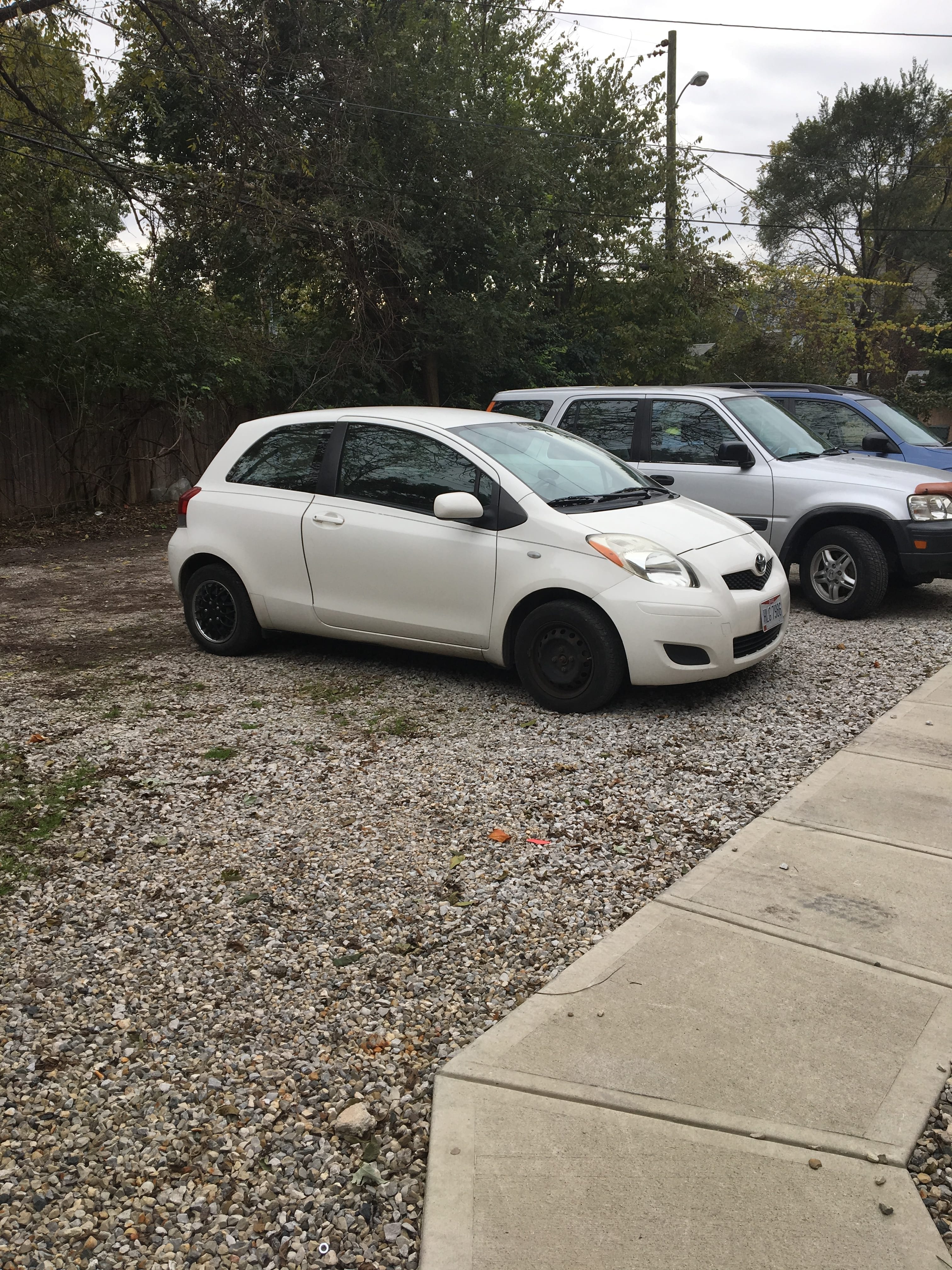
Picture #3

Picture #4
Nearby Businesses
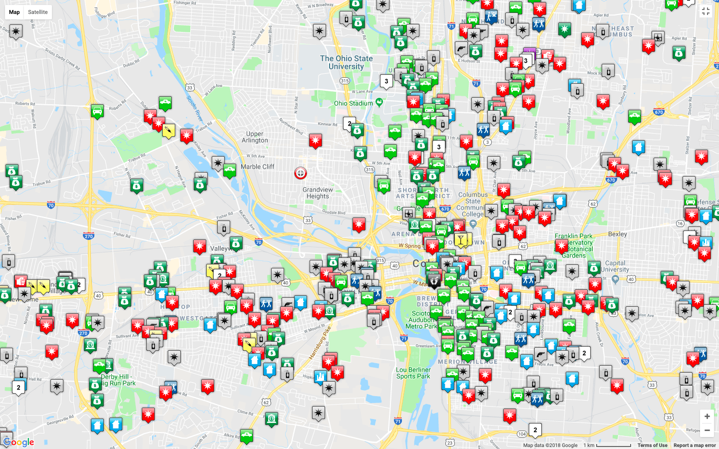
One of the greatest aspects about the CHN University District property is its proximity to a wide range of major businesses, public resources, and religious services. Using Google Maps, one can identify a wide variety of destinations located extremely close to the apartment. (Picture #5) This is largely due to the fact that it lies a block away from both Grandview Avenue (to the East) and 5th Avenue (to the North). These two streets are zoned for commercial use, providing nearby residents with a multitude of restaurants, banking options, and shopping destinations. Two pharmacies (CVS and Walgreens) are located within walking distance, while the nearest grocery store (Kroger) is a mere 1.1 miles away. Public resources nearby include a United States Post Office, Grandview Heights Public Library, Grandview Heights High School, Trinity Elementary School and Larry Larson Middle School. In regards to religious services, the property lies near both Grandview Christian Assembly and Saint Christopher Catholic Church. Based on this information, one can see that the CHN University District property lies in a location ripe with opportunity and resources.
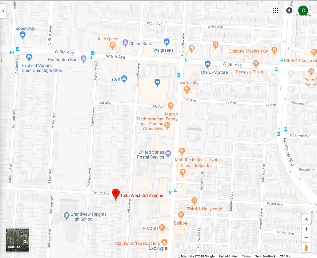
Picture #5
Transit Options
Due to the fact that it is located a block away from two major commerce hubs (Grandview Avenue and 5th Avenue) the CHN University District property is well connected to the COTA Bus Service. (stops denoted by blue icons in Picture #5) 4 stops (2 each way) along Grandview Avenue provide residents with both North and South service on the #31 Bus Route, which originates in Grandview Heights and heads North. Major connections on this route include High Street (access to The Ohio State University and Old North), the City of Westerville, and Easton Shopping Center. One block North of the apartment runs 5th Avenue, which connects residents to the #5 Bus Route. This line runs East/West until reaching High Street, at which point it proceeds to head North/South through Downtown, then East/West again all the way to Reynoldsburg. This route provides CHN University District residents with an efficient way to get to the Arena District, the Downtown core, and the Eastern reaches of Columbus. Considering both the #31 and #5 bus routes run every 30 minutes and both connect to High Street, residents can commute to most of Columbus’ major destinations without a car in an efficient manner.
Crime Rates In the Nearby Area
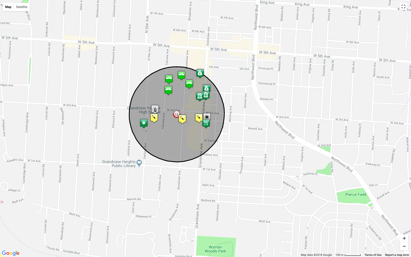
For crime analytics at each of the following distances, (500ft, 1,000ft, 0.25 miles, and 0.5 miles) consult the following pictures.

Crime Analytics – 500ft
Crime Analytics – 1,000ft

Crime Analytics – 0.25 miles

Crime Analytics – 0.5 miles
When the buffer was set to a 0.5 mile radius, the density of crime in the surrounding area was observed. (Picture #6) Thankfully for the residents of the CHN University District property, a vast majority of the crimes occurred two blocks away, targeting the businesses on 5th Avenue. However, there were multiple burglary-by-vehicle reports on Broadview and Fairview Avenue, less than a block away from the apartment. When the radius-observed was changed to 0.25 miles, the hottest density of crime shifted slightly closer to the aforementioned property, lying in the region where the burglaries occurred. However, no matter what buffers were applied to the calculations, the CHN University District remained within a “cool” crime zone; denoting the idea that it is located in a relatively safe area. In regards to type of crime-committed, there were three that stood out in the surrounding area; burglary from motor vehicle, theft, and drug violations. Although the incidence of such crimes is troubling, it is clear that the apartment rests in a fairly safe neighborhood when it is compared to some of the surrounding communities. (Picture #7)

Picture #6
Picture #7
Property Values and Education
Property Values were collected for the following distances (500ft, 1,000ft, and 0.25 miles) and are given below:
- 500ft property value (1327 Broadview Avenue, Grandview, Ohio 43212; south of CHN University District): $310,062 – Rent Zestimate® = $1,700 per month
- 1,00o ft property value (1241 Broadview Avenue, Grandview, Ohio 43212; south of CHN University District): $396,269 -Rent Zestimate®: $1,900 per month
- 0.25 mile property value (1251 West 1st Avenue, Grandview, Ohio 43212; southwest of CHN University District): $651,241 -Rent Zestimate®: $4,097 per month
As seen above, property values tend to increase as one moves South, away from 3rd Avenue. This is likely due to a combination of factors, none of which are related to affordable housing. Moving south, one can see that the area becomes entirely residential (no commercial intrusion). This, along with the fact that a large majority of the crime in the community is centered north of 3rd Avenue, results in heightened property values as one heads south.
Schools in the area (South of CHN University District) include the following, all of which received a 6/10 from GreatScores:
- Cranbrook Elementary School
- Centennial High School
- Ridgeview Middle School
Sources
- https://www.franklincountyauditor.com/
- https://www.columbus.gov/bzs/online-services/Online-Zoning-Map/
- http://property.franklincountyauditor.com/_web/Datalets/Datalet.aspx?mode=&UseSearch=no&jur=025&taxyr=2018&pin=010M062%20%20%20%20%2012100
- https://www.cota.com/wp-content/themes/gotravel-child/PDF/lines/31.pdf
- https://www.cota.com/trip-planner/
- https://communitycrimemap.com
- https://www.google.com/maps/place/1535+W+3rd+Ave,+Columbus,+OH+43212/@39.9849908,-83.0489321,17z/data=!3m1!4b1!4m5!3m4!1s0x88388e4e2a212267:0x2900f6a9f8ebb0c4!8m2!3d39.9849867!4d-83.0467434?hl=en&authuser=0
- https://en.wikipedia.org/wiki/Fifth_by_Northwest
