Disaster Planning – Drought of 2012 (Pineapple Express)

Leading up to the drought of 2012, two main climate factors were at play: a drier-than-normal winter and a hotter- and drier-than-normal spring. By September of 2012, almost two-thirds of the continental United States were suffering from drought conditions. These conditions caused severe agricultural losses; corn, soybean, and sorghum yields all plummeted from pre-drought estimations.

In addition to agricultural losses, there were human impacts. Dust storms were more common, especially in the American Southwest. There were more cases of Valley Fever, a disease caused by a fungus in the Southwest whose presence increases when there is a drought. And the rising cost of crops caused prices to rise for consumers all over the market. Gas cost more because there was doubt over the supply of ethanol, meat cost more because there was less to feed them.

As time progressed past the drought of 2012, the amount of information that different publications had greatly increased. The best example of this is the change in how bad we knew the drought to be over time. early reports in late August 2012 from publications like The Atlantic and Climate Central estimated the severity of the 2012 drought as being behind that of 1988 and the 1930s. However, by April 2013, another Climate Central article had moved the rating up to be worse than the dust bowl and the worst drought since 1895. By April 2013 the cause of the drought was also figured out to be due to natural changes in wind patterns and humidity that combined with the warming climate to create the “perfect storm.”

Firstly, the drop in the strength of the wind coming up from the Gulf of Mexico, combined with the unusually low humidity over the area produced the Drought of 2012. Moreover, the difference in land use and farming practices made it harder for scientists to predict the drought. Finally, many critics argue the reports of scientists failed to say anything about the observed soil moisture conditions, snow cover, and snow pack during the winter prior to the event in spite of the fact that snow pack was at record low levels in the winter and spring.

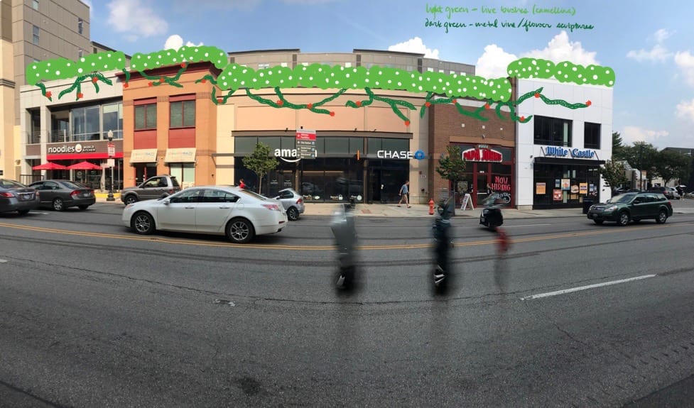
One improvement that could be made is to repair all leaky pipes. Leaks, although seemingly tiny, add up and can waste thousands of gallons of water a year. A second improvement is conserving water: take shorter showers, flush less, don’t leave the faucet on when brushing your teeth, and only wash full loads. A third improvement that could be made is to reuse and recycle water. Install rain barrels to collect water for watering rather than using the hose or tap and install technologies in the home that use greywater (such as dishwasher and shower run-off) for irrigations or other purposes.

Potential barriers to these problems include cost of repairs and improvements, as well as attitude and lifestyle opposition to these changes. The cost of repairing damaged or leaky pipes can be very costly, and people in low-income situations may not be able to afford these repairs. One way to help with this is create programs that provide funding through the government or through nonprofits that help people update infrastructure. While it is incredibly difficult to change attitudes and behavior with water conservation, continuing to educate people and being diligent about providing facts can help the community realize their impact on issues like natural disasters, specifically droughts.

Planning for Housing Site Visit: Poindexter Place (Pineapple Express)

Poindexter Place


Our group researched Poindexter Place (211 N Champion Ave. Columbus, OH, 43203). It is owned and managed by the Columbus Metropolitan Housing Authority (CMHA). CMHA operates with federal funds received from the provisions of the Ohio Housing Finance Agency’s Annual Contributions Contract (ACC) with the Department of Housing and Urban Development (HUD). Poindexter Place serves seniors with affordable apartment housing. The 104 unit building was completed in 2016. It is classified as multi-family (Z73-197, Multi-family, ARLD, 4/11/1974, H-35). It has 106,969 square feet and is currently worth approximately $4,000,000.

Site Evaluation – Document with Pictures
Aesthetics

Our building matches the surrounding architecture style because much of what surrounds it is other Poindexter public housing projects. The village at large does not blend well into the surrounding single-family homes. It is taller than surrounding buildings because of the fact that it is a two-story apartment building. It is denser than surrounding buildings because it is an apartment building next to duplexes and single-family homes. We believe that this building is attractive. It is a fairly new building, but it is well-designed and has a nostalgic feel. The immediate surroundings are similar and form a small community, but outside of Poindexter, the single-family homes are different.

Maintenance

The property is well-maintained, the landscaping and lawn look nice, and the building seems to be kept in adequate shape. The only negative thing we noticed was the trash was overflowing, but it could have been trash day because it was not too bad. There seemed to be enough parking spaces for visitors and for the seniors to have a space for a vehicle too. Landscaping was great, but there could have been more shrubbery and trees. There was a large fence around the parts that were not accessible by people passing by. It definitely could have interacted with the street a little better, but overall it was not too bad. Signage and lighting were clear. There was no graffiti, and we already mentioned the trash issue.

Nearby Businesses and Type

The nearby land uses were primarily public housing or other residential areas. Business does not really exist close, as most of it is near I-71 on E Long Street or on Mt. Vernon Avenue. There is not a grocery store within a mile.

Transit

We saw bus stops at the corner of the lot, we saw that there were lines 22 and 7 going through there. The stops were well maintained.


Secondary Effects
Crime

These are the buffer distances and the number of crimes at each buffer: 500 ft = 21 crimes, 1000 ft = 61 crimes, 0.25miles = 90 crimes, 0.5miles = 167 crimes. When the buffer is set at 0.5 miles, the crime is concentrated at the northwestern , region of the property, which is around the intersection of N 20th Street and Mt Vernon Avenue. Among those crimes, the most common type is assault, which constitutes nearly one-third of total cases.

Property Values and Education

The median Zestimate for nearby properties is $148,200, and home values seem to be on the rise. As you zoom out, the trend seems to be that property values go up, although they are inconsistent across the board. Trevitt Elementary, Champion Middle, and East High are located relatively close to Poindexter Place. All schools are below average; they score a 1/10, 3/10, 2/10, respectively

Links

https://www.bizjournals.com/columbus/news/2018/04/05/take-a-look-inside-37m-final-phase-starts-at-old.html

Comprehensive Planning

Pineapple Express

1) The University District Plan written in 2010 reflects the City of Columbus’ desire to understand that rapid changes affecting the district and continue to be prepared for the unique problems this incredibly diverse area poses. Because so much of the current land use is residential and institutional, the plan focuses on preserving the layout and architecture of existing neighborhoods and limiting the types of commercial development that can occur. High density development is preferred in the plan along High Street until Lane Avenue, and then on Lane Avenue until the Olentangy River. Diversity in transit is a large emphasis, as the plan states people should be able to drive, bike, walk, or take public transit to where they need to go in the University District. A balance of mixed-use buildings in the different areas of the district is desired, as this limits the impact of parking and intrusion into natural resources. In general, the plan recognizes the current boom of development in the district and looks to limit it and its impact on the neighborhoods to preserve the design and keep transit equitable.

2) I think the University District’s Land Use Plan addresses the existence of a massive institution and the externalities of it in a very constructive way. Given that so many students live here and don’t have cars, the encouragement of mixed use zones increases the ease of living for students whose main modes of transportation tend to be walking and biking.

Additionally, the plan’s goal of transitioning areas so that the highest density areas are located near the university and density decreases with distance seems to be a good way to promote the maintenance of a neighborhood feel for families who live in the University District but are unaffiliated with the university.

I also admire the plan’s goals both to preserve as many buildings as possible, preserve open space, and connect natural resources and parks and recreation facilities. I believe that these aspects create a sense of continuity in a neighborhood that’s constantly changing as the university grows and encourage sustainability and outdoor enjoyment. I think the introduction of more open space and green space would significantly improve the feel of the University District and the quality of life for everyone who lives here.

3) According to my observation , most of the planning goals have been achieved, while others still remain to be improved. Firstly, I think planners did a good job incorporating various types of buildings in the neighborhood, also in the mix of land uses near the campus. There are many restaurants, retail shops, bookstores, cinemas and libraries scattered around the OSU campus. On the other hand, when you go a little further away, you can find quiet neighborhoods layed out in an orderly manner. Also, I appreciate that public art has been merged into the design, such as the delicate arches set up in the Short North area. However, I think it’s necessary to add more green spaces along with the sidewalk and limit the available parking space. This would improve the sustainability of the University District.

4) The land use plan for the University District effectively addresses any concerns for the development of the area, employing tactics like floor area ratio and height restrictions to create a dense urban feel in the areas immediately surrounding campus that naturally radiates outward to quieter and calmer suburban areas.

5) One suggestion is parking. It may be better to get rid of minimum parking spaces, especially for commercial buildings but also for other types of buildings. Parking spaces take up space and encourage driving which can discourage pedestrian traffic; it is better for traffic and the environment if more people walked rather than drove. Also, some businesses may not need or want parking spaces so forcing parking onto them does not seem fair. It would also be beneficial to emphasize bike lanes when talking about ‘bike facilities’ because shared lanes where there is just a painted bike on the road doesn’t really encourage biking.


Arts & Urban Revitalization

Pineapple Express

This stretch of High Street is a mix of restaurants, small commercial buildings, and apartments that lacks personality and a cohesive identity from building to building. These buildings are new, but because they are very segmented in design from store to store they will not age well and their appeal as new in appearance right now will fade away over time. Public art could have a significant impact on this stretch of development by providing a unified personality, a more inviting atmosphere for pedestrians, and a greater living space for apartment residents.

The other side of the street (that is physically on campus) has a very bland, “cookie cutter” look. This sidewalk and the buildings it connects lack personality and while they have a beautiful, new look, they will not age well, similar to the buildings across the street. Pedestrians may also feel unsafe walking so close to the street, so public art could not only improve the vibrance and sense of place of this area, but also make people on the sidewalk feel more comfortable. This art could also be a source of shade on a very hot day that Columbus often experiences.

For the commercial side of High Street, we believed that integrating some more “natural” ideas of public art would bring a personal element to the otherwise impersonal business fronts. A rooftop garden would help make the entire stretch of storefronts more appealing while masking the setback top of the new apartment building. The art could also have elements that were not living, such as a vine or plant sculpture, so that the unity between the rooftop garden and the storefronts was even more complete.

On the university side of High Street, we believed that the public art should create a more inviting, homely aspect for students and for casual pedestrians on the sidewalk. The arches would also serve as a physical barrier, causing the people walking on this sidewalk to be less worried about being so close to the traffic on High Street. The sidewalk design would be a cool meeting place for students, and it would provide an incentive to come to this part of campus and interact with the businesses across the street.

Our first step in implementing our ideas would be holding a community meeting and inviting members of the dorms, apartment complex, and businesses these ideas would affect. The discussion would bring concerns to our attention that we would need to address, and would ensure our plan was considerate of the members of the community. For funding, we would first approach the businesses across from campus on this stretch of High Street, as public art would increase foot traffic to their locations. We could also ask the university to support this project, as it would improve student experience and wellness. Setback and safety policy could help provide support to our project, as we would be masking the apartment complex’s extension above the businesses and helping the city provide a safer walking space for pedestrians.

Blog Post 3: Field Assessments


Sidewalks
This is a two-way street, but the pedestrian is only on one side. I think the good thing is that the sidewalk is separated from road by grassland. Therefore, people can walk in a safer way. However, I think it’s better to add a sidewalk, so people can walk on both sides of the street.

Street Safety
This bridge passes over a roadway to connect OSU’s campus to the Olentangy Trail. This is a great way to keep both runners and drivers safe. Runners can pass easily without having to worry about stopping their run to wait for cars or getting hit, while cars don’t have to worry about runners jumping out in front of them. It also helps to keep traffic moving; traffic frequently stalls when classes end at OSU because students keep using “yield to pedestrian” crosswalks. This prevents stopping of that sort while simultaneously making everyone safer.

Street Width
The street width plays an important role in how pedestrians and drivers feel when going gown High Street. Wider streets are more conducive to cars, making drivers more comfortable with driving faster and faster. However, pedestrians can feel unsafe with cars zipping by, feeling especially vulnerable when having to cross an intersection. Since High Street sees a lot of people walking on its sidewalks, it makes more sense to cater High towards pedestrians and not drivers by the street narrower.

Traffic Flow
Measures like the usage of one way streets and terminating roads before intersections help improve traffic flow in the campus area and relieve some of the traffic volume from High Street to help it serve more efficiently as a major artery of Columbus.

Parking
While most professors, staff, and other employees of the university of drive to work, many of the students do not, so the existing parking is definitely enough to accommodate the mass of people at Ohio State. The current layout of parking is definitely functional, but I believe it could be even more functional and offer greater campus traffic safety if there were less parking spaces on the interior of campus. The large parking garages are located on the edges of campus, but more central campus parking should be removed. I think that more bike racks would also be a great improvement, as this would encourage bike usage and a smaller reliance on cars to get around.\


Pineapple Express

Interpreting the City: Images, Elements, and Emotions

Pineapple Express

 Pride

This picture of Ohio Union was chosen for pride because our group loves The Ohio State University and we feel fortunate to be students here. The Union exemplifies the pride we have in our school because of its size, beauty, and its place at the front of the university.

Happiness

This photo of Buckeye Donuts makes me feel happiness because of all the good memories I associate with the place. I’ve been there at all hours of the day with close friends from all different groups, and those memories make me very fond of that location.

Indifference

We chose this picture because we felt that bus stops are important places in a city. No one wants to go to the bus stop, but many people have to stop there to go somewhere else. Therefore, we chose this emotion, as people don’t really feel any sort of way towards a bus stop. Many people do not notice them until they must wait there.

Loneliness

We described this picture as an expression of loneliness because the Chinese style roof stands out among other typical buildings around it. This gives us a sense of loneliness in such an environment.

Hope

Seeing the city of Columbus adopt environmentally friendly and communal means of transportation invokes hope that we can take more steps towards a sustainable future for the city.