Knowlton State Warriors | Hurricane Sandy Blog Post 7

Hurricane Sandy 

Overview

On October 22, 2012 a tropical storm named Sandy was just starting to brew in the Caribbean. It eventually became as severe as a category two hurricane and affected 24 states and multiple countries. By October 29, every state on the eastern seaboard had declared a state of emergency and Sandy made landfall on southern New Jersey. At the time of landfall Sandy was just a tropical cyclone but still had a profound impact on southern New Jersey, New York and really the whole east coast. Sandy is often called a superstorm rather than a hurricane due to the fact that it did not maintain hurricane status at all times but still affected a huge area of the country and Caribbean. Sandy caused an estimated 71 billion dollars in damage and is directly responsible for at least 147 deaths.

Future Improvements

Three simple ways cities affected by hurricane sandy can better prepare for hurricanes, would be to increase stronger infrastructure, encourage citizens to make and have viable evacuation plans, and incorporate plans of resiliency. The biggest issues with hurricane Sandy were caused from buildings notwithstanding the high winds, so increasing infrastructure able to handle the storm will help the resiliency in the cities affected. Many people did not have plans made up in the case that a hurricane was to hit their city, so educating the people on how to evacuate or better prepare is worth investing in. Other people were simply not able to evacuate, so having some sort of public plan in place to help citizens of effected cities is a must.

Vulnerability

One of the main reasons as to why Hurricane Sandy had such a large impact on the East coast was due to its size. Prior to making landfall, this hurricane sustained 74mph winds and above. Which extended anywhere from 175 miles to 485 miles from the epicenter of the hurricane. Not only was the size what caused most of the damage but the track that it took. Normally, hurricanes that move along the east coast of the US are steered out across the Atlantic Ocean by the west to east movement of the jet stream. However, on this occasion, the jet stream was taking a more north to south track, having less of a steering effect on Sandy. This put roughly 60 million people in the path of hurricane Sandy. On the night the hurricane hit. There was a full moon, which only added to the water levels. A lot of the area where the hurricane impacted had a low shore causing record breaking heights of water up to 14ft, sending water into lower Manhattan as 

well. Wind levels in cities were also rather high. 

Communication

One day after Hurricane Sandy

CNN: Sandy wreaks havoc across Northeast; at least 11 dead (2012) reported at least 11 dead in America, with 67 dead in the Caribbean.

New York Times: After the Devastation, a Daunting Recovery (2012) reported about 40 lives claimed.

One week after Hurricane Sandy:

Forbes: One Week Later, The Cost of Hurricane Sandy (2012) reported $30-50 billion in estimated damage cost and over 100 people confirmed dead along with about one million people without power.

One year after Hurricane Sandy:

Weather-bug: Hurricane Sandy, One Year Later (2013) estimated 147 people dead from the storm and 87 dead from indirect causes. $50 billion was the estimated damage cost.

Implementation

The process of implementation would be very long and tedious but in the long run it would help the area immensely. Improving infrastructure to withstand the hurricane conditions would be the first thing to tackle. Backing and lobbying fro policy that would provide funding for the improvements should be done as well as applying for grants through foundations that are aimed at helping communities that endure hurricanes quite often. Once funding is acquired, which is easier said than done, the actual improvement can be done. Implementing plans for your citizens can also have a profound effect on survival rates during hurricanes. Making it a law that if the government issues a mandatory evacuation everyone must leave, but the government should provide stable housing and transportation for the evacuees in the meantime. Implementing a plan of resiliency would require the communities involvement, not just the local government mandating that everyone be educated in hurricane evacuation, aiding people in rescue, and other preparedness material. The government will have to fund classes, make sure the lower class people know about and attend the classes, and making sure materials and resources are available for emergency packs for residents. All in all, the implementation relies on funding from organizations and the local government as well as cooperation from the residents so that they take their own safety and preparedness into their own hands. The big barriers are funding and access to information and I believe determined groups can succeed in lobbying for funding that will help implement and spread information. 

Knowlton State Warriors | Blog 6 Field Assignment

130 Piscitelli Pl. Columbus, OH

Site Evaluation

Aesthetics

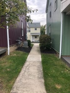
  •  The property is surrounded by some older multifamily and single-family homes as well as flanked by some more modern style apartment buildings.
  • Overall New Village Place fits in pretty well into its’s surroundings given that the architectural style isn’t super modern nor super old looking. It blends well and doesn’t make it look like public housing.
  • I would consider it an attractive building, but it isn’t the most attractive building. It blends in.

Maintenance

  •  The landscaping of the building is very well kept, and the overall sanitation of the facilities is very good. A few places were slightly ungroomed, but the rest was very well groomed in terms of grass and foliage.
  • The parking situation is very good, every until seemed to have designated parking and there are a couple of larger lots wedged in between buildings.
  • Street lighting was average and was on the outside as well as inside of the complex.

 Nearby Businesses and Type

  •  The nearby land uses include very few stores. Across the street to the east there is a primary school and to the south and west there are other residential zones. The closest grocery store is almost exactly a mile from the complex. The closest businesses were restaurants and smaller storefronts.

 Transit

  •  The nearest bus stop is very close. It is maybe 500-600 feet to the northeast of the complex. The lines available are all the COTA lines. The Bus stop was an unprotected bench area with the bus stop sign with the lines described on it. It has protected bike lanes very close to the complex due to being very close to Summit Street. Summit street is also a major car thoroughfare.

Secondary Effects

Crime

  •  At the 500ft radius there was very little crime, just one theft. At the 1000ft radius there were a few more individual burglaries. At the .25 miles, there were quite a few theft and burglaries but no murders. At the .5-mile radius there were no murders either, but more thefts and burglaries.
  • At the .5-mile radius the crime is concentrated to the north of the New Village Place and there is barely any crime around the location itself. The most common crime is individual burglaries.


Property Values and Education

 Zillow Zestimate

  •  There is no Zillow Zestimate for the units in our building. The Montessori School across the street does not have any rating data on it. We tried to find the correct pricing for the units, but no website gave current prices as contacting the owner would be necessary they were all currently being leased.

 Education

  • Weinland Park Elementary Schools – Score 2/10
  • Hubbard Master School – Score 3/10
  • Harambee Christian School – NR
  • Indianola Informal K-8 School – Score 4/10
  • Columbus Collegiate Academy – Score 6/10
  • Arts Impact Middle School – Score 4/10
  • Youthbuild Columbus Community – Score NR
  • Fort Hayes Career Center – Score NR
  • Fort Hayes Arts and Academic High School – Score 4/10

 Site Characteristics


  • Name of Property: New Village Place
  • Owner/Manager: Columbus Metropolitan Housing Authority
  • Type of Funding: Public/Government
  • Population Served: City of Columbus on the Northern Side
  • Year Built: 2004
  • Number of Buildings: 4
  • Number of Units: Approx. 16 (Not completely sure because of conflicting information)
  • Land Use Classification: Exempt Property
  • Square Footage of Building: 12,760
  • Total Assessed Value: $1,798,600


Knowlton State Warriors | Blog 5 University District Plan

Introduction

“Neighborhood plans address future land use, urban design, and capital improvements. They provide an opportunity for community stakeholders to help shape and direct the pattern of growth and development in their area. Two primary ways a neighborhood plan is used are to guide neighborhood and city review of development proposals and to inform future investments in the area.”

Existing Conditions

“The Existing Conditions section provides a summary of the planning area’s data and trends that inform physical planning and change. The report reviews the area’s physical attributes, including land use, zoning, transportation, and environmental resources. Current and forecasted demographics, economic trends, and a historical context of the planning area are examined as well.”

12 neighborhoods make up the University District. There are 4 historic districts. There were previous plans such as a design for High Street. 49 percent of the land is used for residential, and 39 percent is institutional. Most of the land on High Street is commercial, and most of the land North, East, and South of OSU is residential.

“The Urban Commercial Overlay… establishes additional standards and requirements on top of underlying zoning to commercial properties.”

The document then goes over the demographics, tax increment finance areas, transport networks, and environmental resources.

Over the last few years, denser development such as student beds and parking has impacted the University District.

Recommendations

“The Plan Recommendations section addresses land use, urban design, and capital improvements. The development principles, policies, guidelines and strategies are an outgrowth of existing conditions analysis, stakeholder input and staff analysis. They respond to identified priorities and are consistent with overall city development-related policies. Each development principle is followed by supporting policies, guidelines and strategies. Capital improvement recommendations will serve as the area’s Urban Infrastructure Recovery Fund (UIRF) priorities.”

The document goes over Floor Area Ratio and Land Use Plans. The Land Use Plan of each street/house is laid out on a map. The mixed-use zoning ideas are explained.

Natural Resource and Parks and Recreation Facilities are explained.

The design principles are then explained, including Historic Resources and building design, and landscaping.

Then Residential Development ideas are explained, along with parking lots, garages, Graphics, and art.

Next, Capital Improvements, or improvements to neighborhood infrastructure are laid out.

Implementation

“The most effective way to implement the provisions of a neighborhood plan is through the consistent and unified advocacy of area residents and businesses working in concert with the city of Columbus and other stakeholders. The most typical mechanism for plan implementation is the review of development proposals for consistency with the plan. Additionally, the plan can be used proactively to seek investment in the area, advocate for neighborhood issues, pursue grant funding and guide capital improvements. As indicated, this plan will serve as the area’s list of UIRF priority projects.”

  • The land use recommendations in this plan are actually extremely agreeable to me. There are a lot of positive points and I feel like if the recommendations are followed progression will be viewed as primarily positive. The first good thing is the focusing of development on the campus area and not as much the surrounding area, this allows people who live here and aren’t involved with OSU a little space and separation from it. Another good thing is the focus on density in order to make the district very walkable. I also like the mixed land use goals and variety of land use encouraged. The different usages of intensity of that usage allows for diversity and several different feelings depending on where you are in the district. It also allows you to live, shop, eat, etc. all very close together. Finally, there is a good point in there about encouraging sustainable building and green practices. I think every recommendation these days should contain a sustainable element.
  • The plan for The University District describes the land use objectives for the area and they are pretty consistent to what has been going on recently with new developments. For example, the new developments on High Street are designated for Regional Mixed Use which is the case for all of those developments including the new Target which also has apartments above the store. They do also state that there must be a park or recreational facility within one-half mile of all residents within the district all within the City’s Parks and Recreation Master Plan. I think there are definitely more parks that could be put in to increase the green space in the district as it is very residential and commercial outside of the University campus. They state that High Street and Lane Avenue will continue to be the main corridor for mixed use and densest development, which is line with recent developments. They have a pretty strong sense of conservation in the plan and they say that any building with significant impact on the historic fabric of the district must be rehabilitated and maintained, but I do think that knocking down building after building on High Street doesn’t necessarily follow this guideline.
  • According to the principles behind the land use of the University District, the goal is focused in the proper direction. Where mixed use buildings are said to be focused on main street and walking up and down that particular area it is easily noticeable of the mixed use of the buildings for both commercial and residential. It also addresses the importance of accessibility by walking, biking and cars, all of which are a major priority and easily noticeable by the roads, and the walkways across the campus. Parking also is not dominating the University District, with the use of parking garages limiting the area and composing it towards the sky in a much denser area. The area is also utilizing green spaces and is conserving the existing land and feel of the parks and natural environment. Thus, the guiding principles seem to be shaping the University towards the right direction and the outcome is noticeable.
  • The recommendations we have regarding the University District Plan are focused in the area of transportation and walking about the area.  The third guiding principle discusses how people should still be able to move around by walking, car, transit, and bicycle.  All of these ways of transportation are available, but some can be more difficult and less safe than others.  The major concern we have is crossing high street when walking to and from campus or other areas.  There is a lot of traffic on high street all the time and it is very unsafe to cross the street a lot of the time.  One solution to this problem would be to incorporate a couple of walking bridges across high street at major crossing points to reduce accidents and traffic.  Another recommendation for this principle of the plan is to incorporate more bike racks along high street.  The plan wants the use of bicycles to increase, but there are not many bike racks along retail buildings to leave them at while visiting.  The last recommendation is to improve bus stops.  Many of the bus stops have been improved, but others are still simply a post.  To encourage transit use in the area, better bus stops for people to wait at would be a good start.


The Knowlton State Warriors | Field Assignment: Blog 4

Right now, a walk down North High St. between Woodruff and W Lane Ave. reveals that there is little to no public art. The walls of buildings are completely blank, and there is no visible art whatsoever. The sidewalks have no color or decorations. A stronger art presence could bring in a new crowd of people who appreciate art. It could also attract more art-focused businesses that embrace art as a form of expression and advertising. It would help create a more inviting space for people to gather around, instead of being a way for students and residents to get from point A to point B. This would attract people to want to spend more time and money in the University District.

Our first recommendation is for the “Old North Columbus” Arch. We propose that we run a strong underneath the arch from one post to the other. Along that string we attach old carriages in the form of cutout silhouettes. The other detail would be a silhouette of a carriage conductor leaning up against the post of the arch on the west side of the street. The reasoning behind this installation is that the Old North Columbus was home to a major horse carriage station during the early years of the city. We think that this proposal alludes back to the history of Old North Columbus and also refreshes the arch which has become unnoticeable as everyone is used to its sight.

An area we saw that could use some revitalization was in front of the Ohio Stater’s building. The building is very bland and also has some chipping paint. On top of this it is very boring and doesn’t look like it should belong on campus. The name of the building suggests otherwise though as it is called the Ohio Stater. We felt that to bring this space more life, adding a mural of Ohio State and some of its prominent features would really do the site justice. The hope is to bring some color and pop to such a bland building. Our mural would add some excitement with the classic “Go Bucks!” phrase and some classic pictures of places on campus as well.

For the Old North Columbus sign and the mural outside the Ohio Stater’s building, our plan is to further its link with the community there. To do so, we would first need to fully design the project with the help of an artist. After the design is complete. The project will then need to be created, thus hiring both someone to design and to actually implement the project. As the project is not extremely large, it can easily be paid for through taxes and through a community fundraising effort. Both the arch and the mural could be funded as they both would be inexpensive. Leading a community push at city council to form a push for funding could also help but is not seen as being necessary for this scale project as long as they are approved by the local governing body.

Blog #3: Field Assessments | Knowlton State Warriors

Christian Harris, Cole Bretl, Jacob Stevens, Arick Smith, Joey Warnkin

Building and land use

OSU has very good building use for the most part but the land use around Lincoln and Morrill Tower is sub-par given that the towers were built on pieces of land higher than the land surrounding them which makes it hard to use that land effectively and they only built a parking lot in between the towers. Building on sloped ground limits the possibilities and they did not plant a lot of trees to make it look aesthetically pleasing to my eye either. Land being used in a more efficient and beneficial way is the land use by Mirror Lake which is used for beautification while also offering a nice lace to walk around and sit down. Overall the building and land use we encountered was very good and was very pertinent to the use fo students and faculty. I do think more complex green spaces could be implemented in the campus, instead of just square or rectangle green spaces. Putting grass and foliage in places like parking garages and parking lots would increase the beauty and use of the space.

Sidewalks

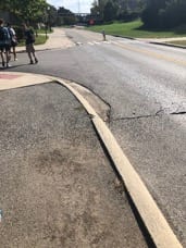
Starting from the Knowlton front doors the sidewalks are in great condition. They continue in great condition thought the St. John Arena and stadium area. I believe they are in great condition in these places because they are always being walked on and there is always heavy foot traffic in that region. However, once we got past the stadium and behind the towers, the sidewalks became terrible. They are almost unwalkable for a stretch. It is probably this way because they is kind of a neglected area, from the towers to the medical buildings there isn’t that much going on. Heading back east towards the oval the sidewalks became well paved again, not quite as good as north campus but still walkable. Once we were on high street the sidewalks were okay, they are in pretty good condition but not perfect because it is such a busy street. Through the whole trip there weren’t any major sidewalk gaps.


Traffic

As we traveled along the route around campus, we couldn’t help but to observe the traffic.  Just about everywhere there are two lane roads on campus.  This is a good thing in some areas and not such a good thing in some areas.  For the most part traffic generally flowed pretty well in all areas of campus.  One can attribute this to the fact that there are not too many roads on campus that are welcoming for a lot of traffic.  This was a smart design, given that there will be thousands of students walking around all day.  An area of interest that sparked some negative review was the hospital area and surrounding parts (see below).  Here there are still only two lane roads, but the traffic is much busier.  The issue is that the main academic core is blended with the university hospital.  This results in students walking everywhere and there being traffic everywhere because patients for the hospital and students are both in this area.  This area did not seem to flow very well at all and the traffic lights don’t appear to be on good timers.  There is also a no right turn on red sign that some people didn’t follow at the light.  Another area of interest was high street.  This is a busy road because it handles the bulk of the traffic because it is right on the edge of campus.  For Ohio State this is great, all of the traffic is on the edges of campus and not going through the center of things.  For everyone else trying to get away from campus or maneuver along high street, thisis not so great.  The main issue here is the bulk of pedestrians crossing high street.  There are cars constantly having to stop for crossers and the flow of traffic is always interrupted.  There are lots of safety concerns for students crossing high street and for drivers looking out for students.  For many of the issues with traffic on campus it could all be solved by implementing better pedestrian walkways.  This may include bridges and better crossing areas.  This would improve the flow of traffic and alleviate any safety concerns.

Parking

According to the picture and walking directly through the parking lot, it seems that parking around campus and near the stadium is sufficient yet it creates a problem of distance needed to travel by foot once the vehicle is parked. Though it seems to be functional and working well regarding parking space and room. Creating more parking garages instead of large lots could help reduce space while creating space vertically. Thus it could help better the usage of land to increase parking and decrease area used for parking purposes.  But consideration for the increased volume of cars should be taken into account.

Safety

Walking around campus, discrepancies in street safety became evident in different areas.

Here, West of Ohio Stadium on Cannon Drive, the sidewalk feels very close to oncoming traffic. There is no safety precaution to keep the pedestrians from falling onto the street or warning them that they are too close.

On the other hand, this bridge allows for pedestrians to safely cross Cannon drive without a crosswalk from a parking lot near the Drake Performance Center.

This sidewalk on John H Herrick Drive gives pedestrians an approximate six foot grass buffer from the oncoming traffic.

Crossing John H Herrick Drive, this sidewalk is very wide (approximately 15 feet) and lets pedestrians cross easily and safely. One drawback to the location is that this intersection is very busy and pedestrians may end up cutting off traffic.


Knowlton State Warriors Picture 1

This construction site really conveys the emotion of frustration because a lot of construction on our campus and along High Street tends to frustrate myself and a lot of my fellow students. Especially something that blocks or hinders a key pathway for walking and is not being worked on consistently.

Team and Logo

The Knowlton State Warriors are hoping to start this season off on a good start with the new additions coming in during the offseason which include Christian Harris, Joey Warnkin, Jacob Stevens, Arick Smith, and Cole Bretl.